← Back to the Laval map
Area · Pont-Viau, City of Laval

Pont-Viau

A bridge that's nearly two centuries old, a metro station right in the neighbourhood, and a cove born from a dam. Here's my top 10, the neighbour's version, not the brochure's.

Let's talk about this area

Pont-Viau is the first piece of Laval you reach coming up from Montreal across the rivière des Prairies. The neighbourhood sits in the south-central part of Île Jésus, wedged between Laval-des-Rapides to the west, Duvernay to the east, and water to the south. It's a small territory, but it already counted 14,187 residents at the 2011 census, making it one of the most tightly packed corners of the city. Nothing like the long bungalow streets of northern Laval.

What I like showing people here is the contrast. On one side, boulevard des Laurentides and boulevard de la Concorde, two busy commercial arteries. On the other, just three streets away, quiet shorelines, a small park lighthouse, and two large religious houses surrounded by mature trees. Few areas in the region switch between the two so quickly.

I put together this top 10 for a simple reason: when you buy or sell, you're not just shopping for a property, you're shopping for a neighbourhood life. Each point comes with an opening for a conversation. Use it.

Maxime Laforest, residential and commercial real estate broker · Équipe Loiselle, RE/MAX Dynamique

The area's top 10

What makes the heart of Pont-Viau beat.

Ten reasons Montreal buyers are looking to this side of the river, and why the people who've settled here don't leave.

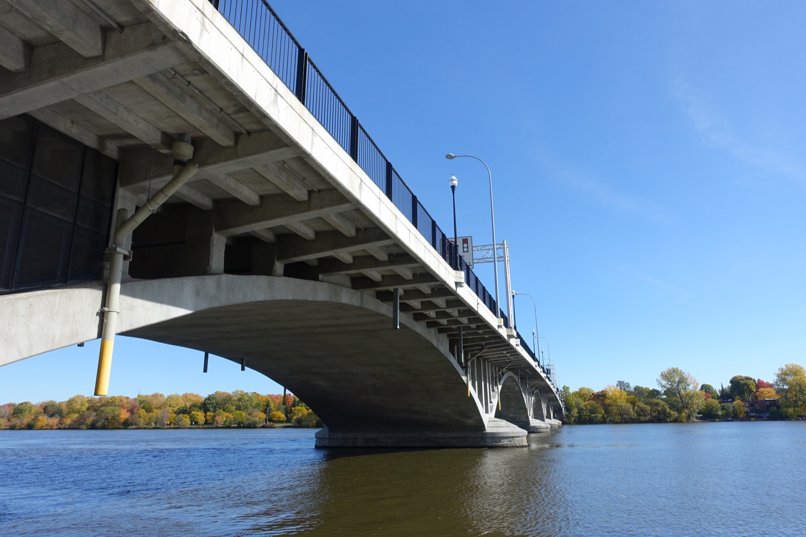
01 The concrete arches of the Pont Viau seen from below, from the shoreline in Pont-Viau
The icon

The Pont Viau, the bridge that gave the neighbourhood its name

A first wooden bridge crossed the rivière des Prairies here as early as 1847, rebuilt in steel in 1887, then in concrete in 1930 under architect Marius Dufresne. It carries route 335 over 429 metres, with five lanes including a centre lane reserved for buses, sidewalks on both sides, and a bike path. About 29,000 vehicles cross it every day, plus 7,000 pedestrians and cyclists. The name comes from Christophe Veau, the first settler on the land, whose surname was misspelled in the old registries. It stuck as Viau, for the bridge and for the neighbourhood alike.

Ask me about it: ask me how many minutes it really takes to walk or bike across to Ahuntsic. A lot of buyers are surprised by the answer.
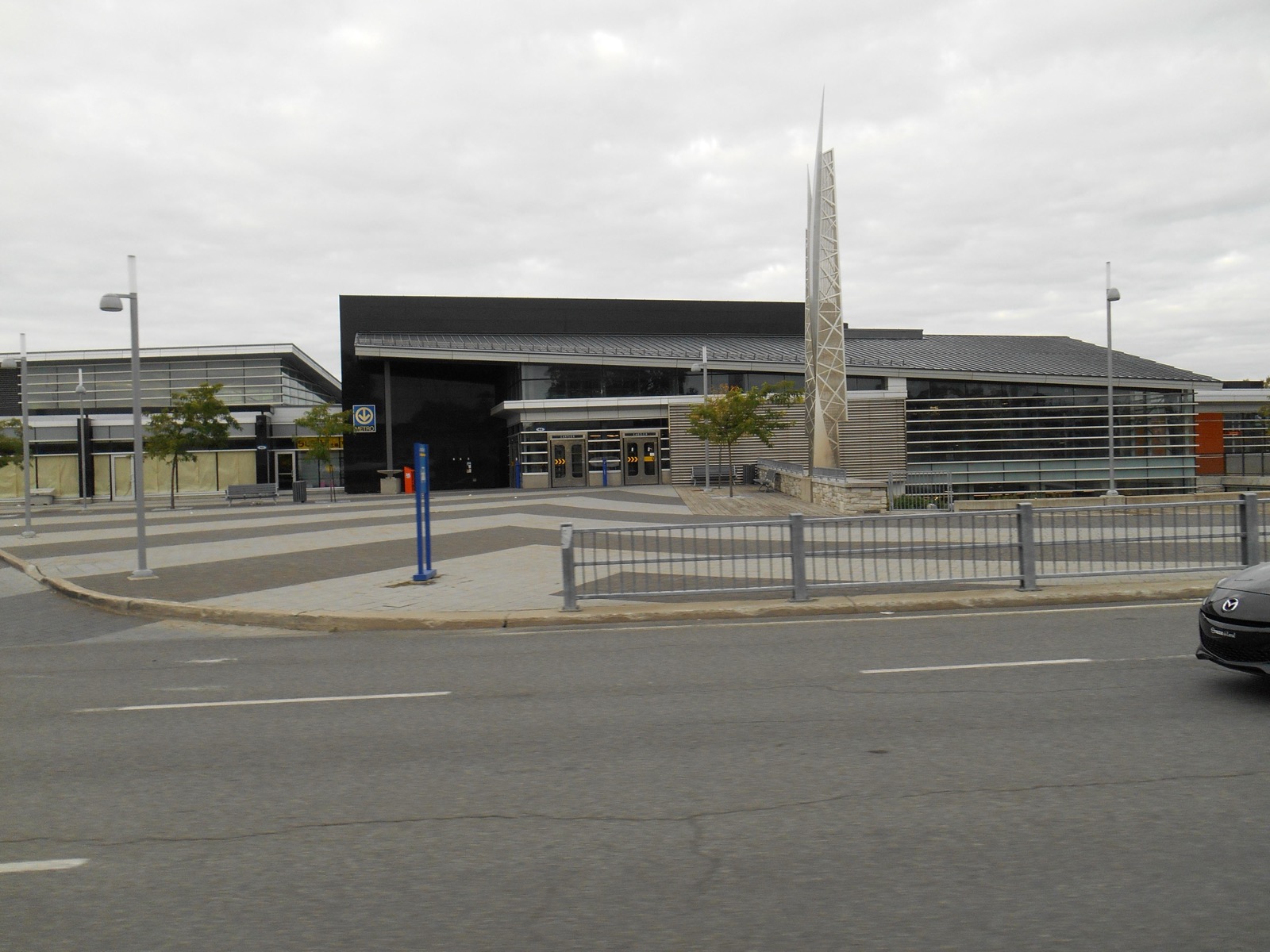
02 The entrance pavilion of the Cartier metro station in Laval, with Jacek Jarnuszkiewicz's steel sculpture
Transit

A metro station right in the neighbourhood

Cartier station, opened April 28, 2007 with the extension of the orange line, sits on the border of Pont-Viau and Laval-des-Rapides, at 5 boulevard Cartier Ouest. It's not just a metro entrance: it's one of Laval's biggest bus terminals, with about twenty STL routes and exo Laurentides lines converging there. It logged close to 2.5 million entries in 2023. At the entrance, Jacek Jarnuszkiewicz's stainless steel sculpture stands eleven metres tall.

Ask me about it: ask me which streets in the area actually get you to the station on foot in winter without a detour. It's the kind of detail that changes a decision.
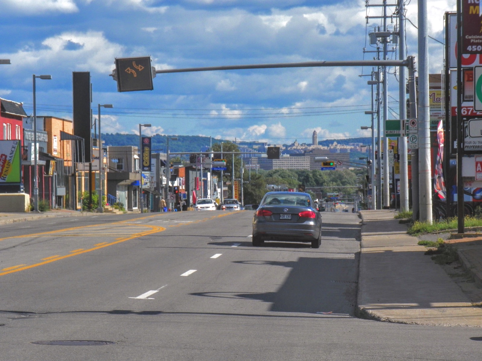
03 Boulevard des Laurentides in Pont-Viau, with Mount Royal and Saint Joseph's Oratory on the horizon
Main roads

Boulevard des Laurentides, the old road north

Laid out in 1890 as montée Sainte-Rose, this 13.3-kilometre boulevard was the main route between the Laurentians and Montreal until Highway 15 opened in 1958. It runs the full length of Pont-Viau, ends at the Pont Viau, and becomes rue Lajeunesse once you're across the river. It's the neighbourhood's commercial backbone, with a centre lane reserved for left turns. And looking south, you can see Mount Royal and the dome of Saint Joseph's Oratory at the end of the street.

Ask me about it: ask me how I handle noise and traffic when a property faces a main road like this one. There are honest ways to present it.
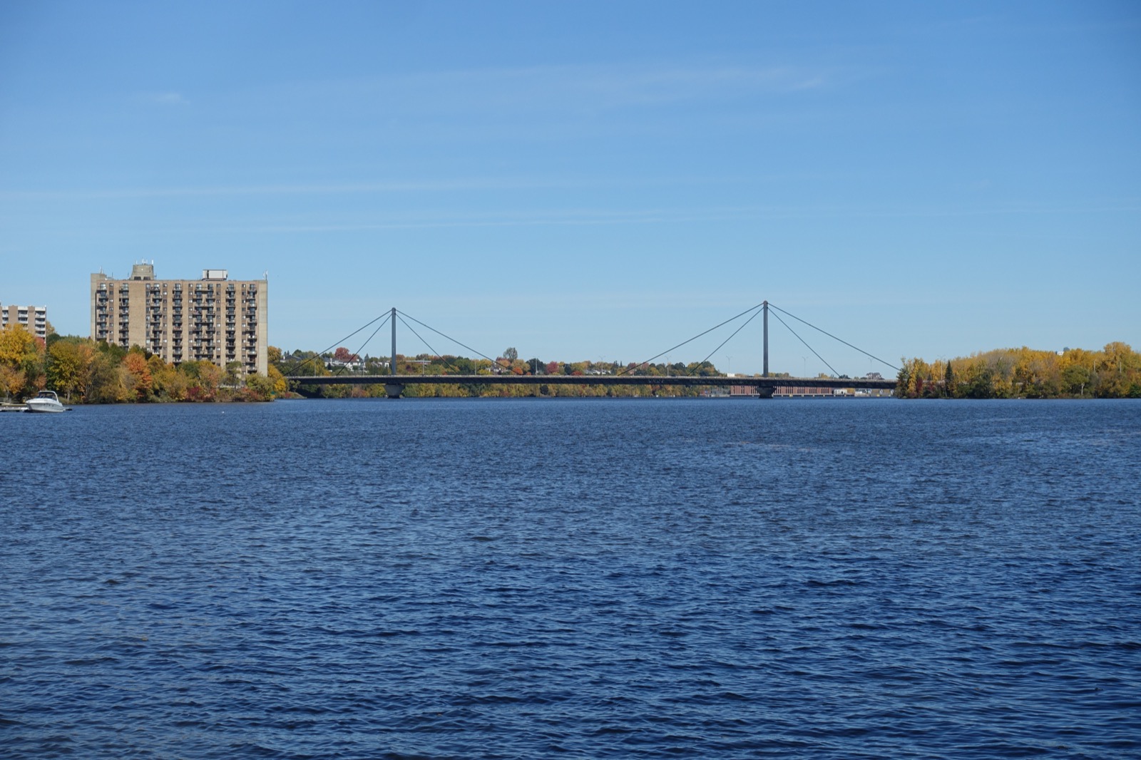
04 The Papineau-Leblanc Bridge and its cable stays, seen from the berge Délia-Tétreault in Pont-Viau
Access

The Papineau-Leblanc Bridge and Highway 19

East of the neighbourhood, the cable-stayed boulevard Papineau bridge has spanned the river since October 1969, with a 241-metre main span. It carries Highway 19 and sees about 56,000 vehicles a day. Its name honours Joseph Papineau and Alpha Leblanc, a market gardener who owned the land where the approaches were built. The ministère des Transports is extending the highway toward Bois-des-Filion and Highway 640, with lanes reserved for public transit; work on the Saint-Saëns interchange started in fall 2021.

Ask me about it: ask me what the Highway 19 extension could change for commutes in the next few years. It's worth factoring in before you buy.
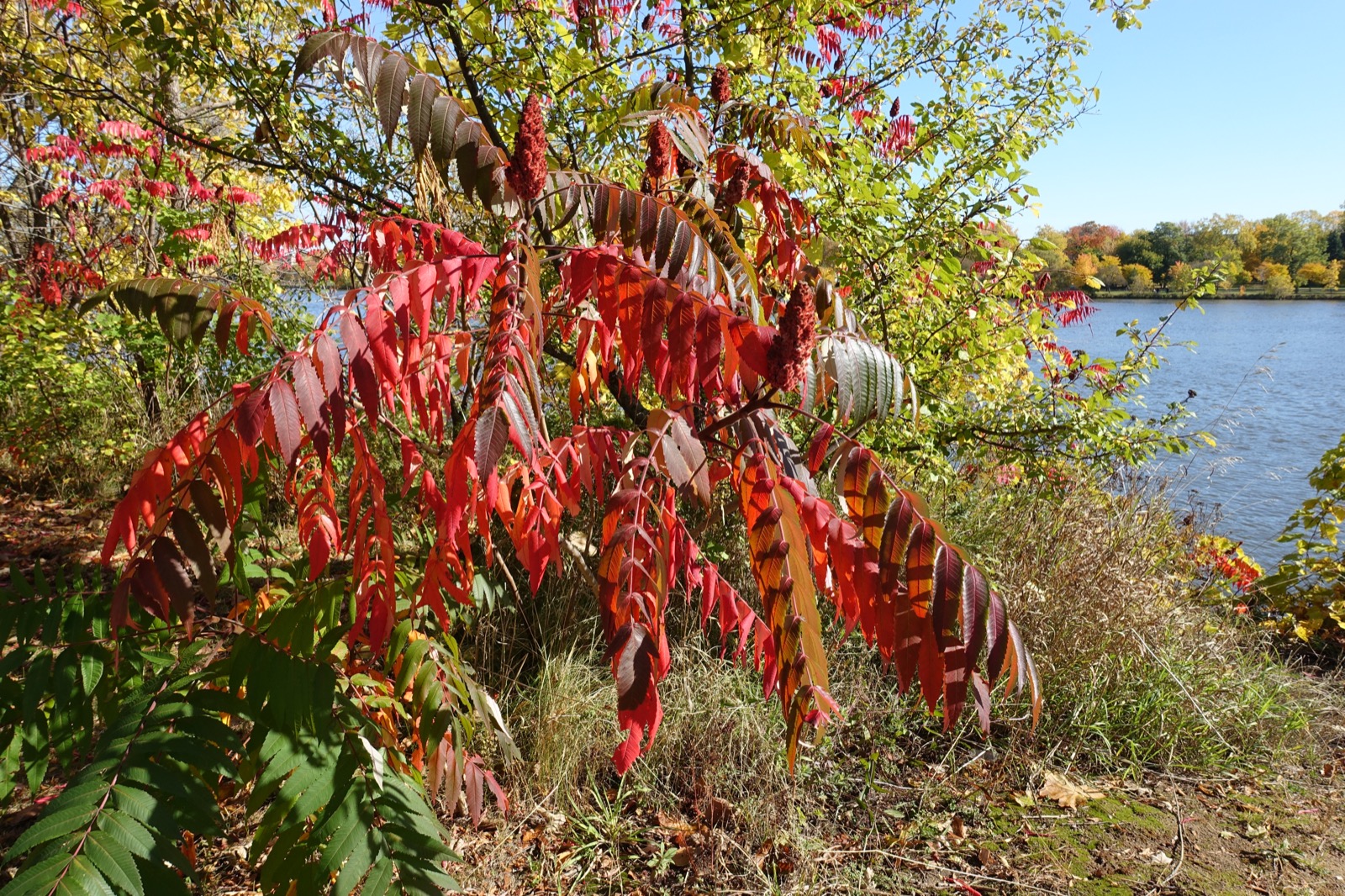
05 A sumac in fall colours by the water, at the berge Délia-Tétreault in Pont-Viau
Nature

Public shorelines three streets from the shops

The city has built a series of small waterfront access points that give the area its quiet charm: berge Délia-Tétreault, berge du Père-Dalmas, halte du Marigot, and halte des Libellules. Add parcs Rosaire-Gauthier, Dufresne, and Henri-Dunant tucked into the residential streets. They're not big spaces, but there are a lot of them, shaded by mature trees, and you'll run into more residents than tourists.

Ask me about it: ask me which of these shorelines are actually walkable from the streets you're looking at. They're not all equal.
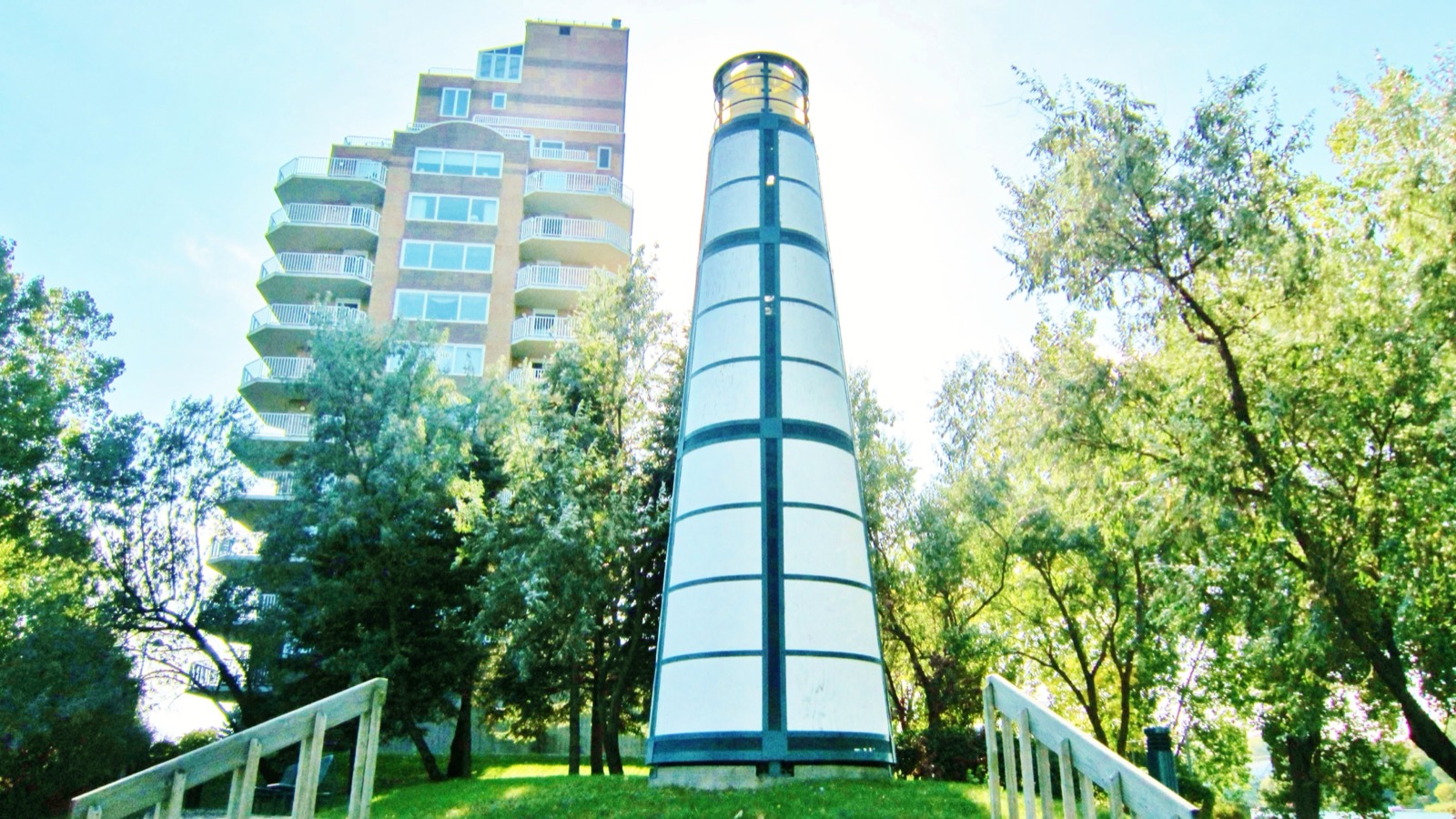
06 The decorative lighthouse on the presqu'île Juge-Desnoyers in Pont-Viau, in front of a condo tower
Waterfront

The Marigot and its little lighthouse

In the late 19th century, the area's first houses clustered on the presqu'île du Marigot, near the bridge. In 1927, Montreal Island Power announced a dam on the rivière des Prairies, and the land south of boulevards Lévesque and Cartier ended up flooded. Owners moved north, which kicked off development of the rest of the neighbourhood. What's left of all that is a quiet cove, the presqu'île Juge-Desnoyers with its park lighthouse, and residential towers that get the water view.

Ask me about it: ask me which addresses on the peninsula have a real water view rather than a glimpse between two trees. They're easy to count.
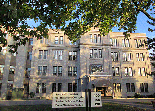
07 The facade of the Missionary Sisters of the Immaculate Conception house, place Juge-Desnoyers in Pont-Viau
Heritage

Two large religious houses on place Juge-Desnoyers

On the peninsula, two institutional complexes occupy large wooded grounds. The Missionary Sisters of the Immaculate Conception, a congregation founded in 1902 by Délia Tétreault, keep their Pont-Viau house here, home to the Délia-Tétreault museum. Pope John Paul II declared the foundress venerable in 1997. Right next door, the Missions étrangères society also holds a large estate. These properties explain why this corner of the neighbourhood stays so green despite its density.

Ask me about it: ask me what having large institutional grounds nearby changes for a neighbourhood over the long run. It's a question I ask myself every time.
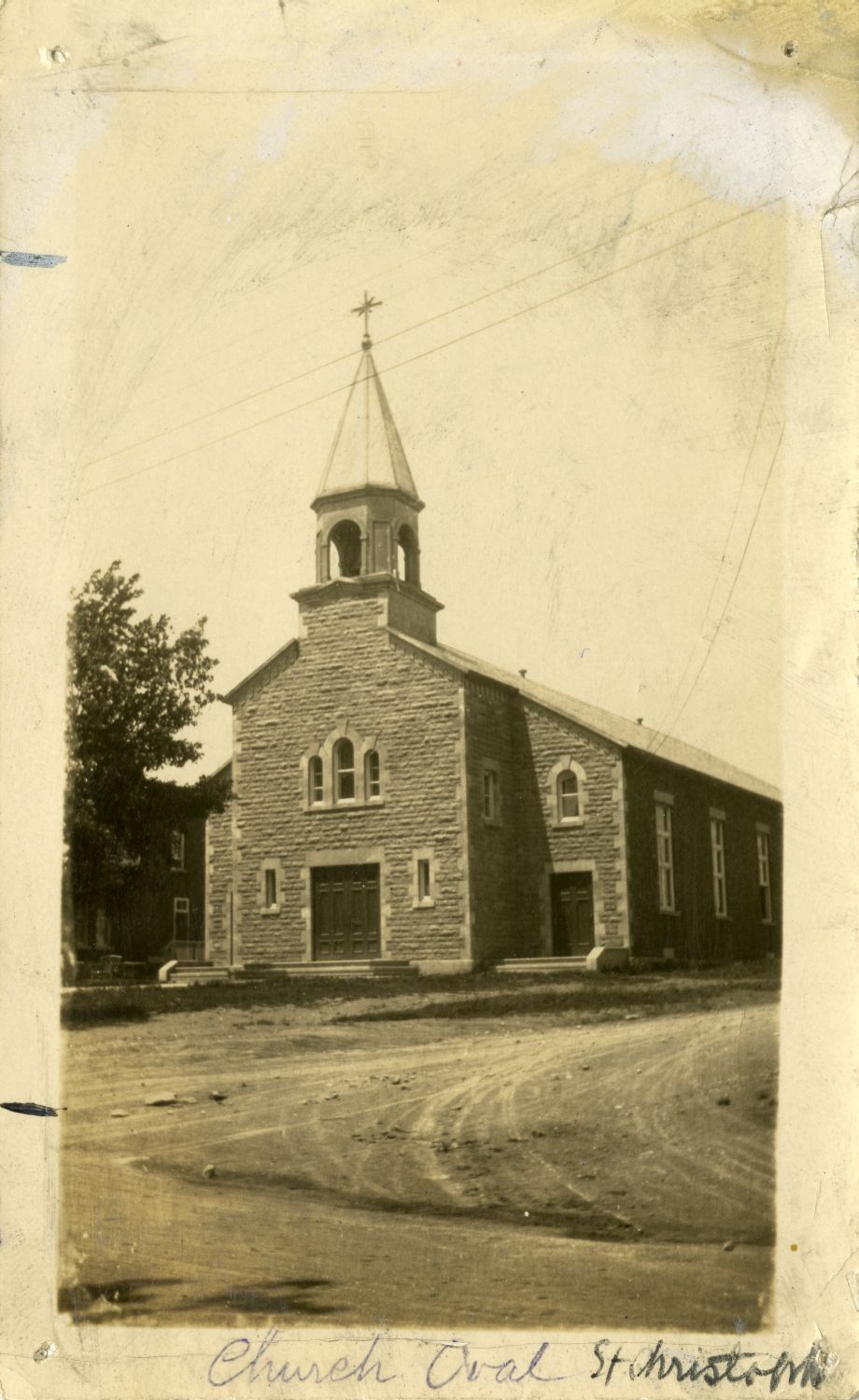
08 Archival photo of the first stone church of Saint-Christophe-de-Pont-Viau
Memory

Saint-Christophe, the parish that became a residence

The territory's first Catholic parish was founded in 1915 under the name Saint-Christophe, honouring pioneer Christophe Veau. Before that, Pont-Viau was just one of the village cores within the parish of Saint-Vincent-de-Paul, which would later become Duvernay. The church itself was converted into a seniors' residence. The name lives on in other ways in the neighbourhood, on business signs along boulevard des Laurentides.

Ask me about it: ask me where the old village core sits within today's neighbourhood. The oldest buildings are there, and they don't all look alike.
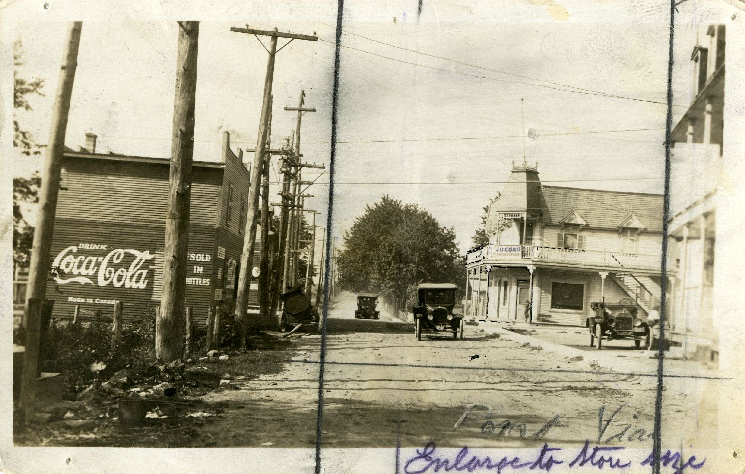
09 Archival photo of Pont-Viau's main street, with vintage cars and a painted Coca-Cola wall
History

A town before Laval, and its first mayor

Pont-Viau became an independent municipality on April 6, 1926, a town on May 10, 1947, then a city on February 6, 1958. In 1951, it built a filtration plant well beyond its own needs and ended up selling drinking water to Laval-des-Rapides, Duvernay, and Saint-Vincent-de-Paul. When the fourteen municipalities of Île Jésus merged on August 6, 1965, Pont-Viau was the densest and one of the most built-up, at around 90%. Its last mayor, Jacques Tétreault, became Laval's first elected mayor.

Ask me about it: ask me why a neighbourhood built this early behaves differently from Laval's newer areas. It shows in the buildings and in the zoning.
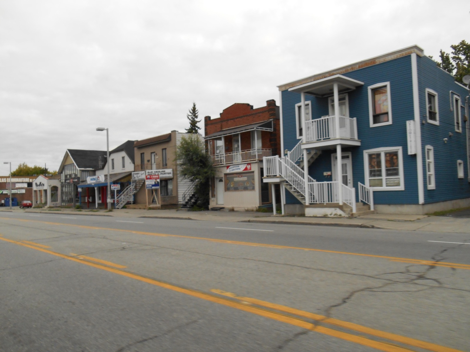
10 Duplexes with outdoor staircases and small shops along boulevard des Laurentides, in Pont-Viau
Neighbourhood life

Corner shops and walkable schools

Daily life here runs on foot or by bus. Shops line boulevard des Laurentides and boulevard de la Concorde Est, with addresses that have lasted decades, like Delicatessen St-Christophe. On the school side, the Centre de services scolaire de Laval runs four elementary schools in the area: Eurêka, des Perséides, Saint-Gilles, and Saint-Julien. There's no high school in the neighbourhood: kids north of boulevard de la Concorde go to école de la Croisée in Chomedey, and those south go to Mont-de-LaSalle in Laval-des-Rapides.

Ask me about it: ask me to check the exact school catchment for an address before you make an offer. The dividing line literally runs through the middle of the neighbourhood.
Let's talk

Thinking of buying or selling in Pont-Viau? Let's start with a conversation.

A free evaluation of your property, a picture of the local market, or simply answers to your questions. No strings attached, and a straight answer.

Start my real estate project

Photo credits