← Back to the Laval map
Area · Duvernay, Laval

Duvernay

Laval's largest neighbourhood, a two-hundred-year-old beech forest, and farm roads where people still grow crops. Here's my top 10, neighbour's version, not brochure version.

Let's talk about this area

Duvernay is the east end of Laval, between the Autoroute Papineau corridor and the edge of the Saint-François neighbourhood, with the rivière des Prairies as its southern border. From my home base in Verdun, I head up Highway 25 and cross the Olivier-Charbonneau bridge, or take Highway 19 and the Papineau-Leblanc bridge when traffic allows for it. I work with buyers looking for a bigger lot without leaving the metropolitan area, and sellers who've been settled here since the 1960s, when the whole area was going up.

I put this top 10 together for a simple reason: when you buy or sell, you're not just shopping for a property, you're shopping for a neighbourhood life. Every point comes with an opening for a conversation. Use it.

Maxime Laforest, residential and commercial real estate broker · Équipe Loiselle, RE/MAX Dynamique

The area's top 10

What makes Duvernay tick.

Ten reasons buyers cross the rivière des Prairies heading east, and why the ones who settle in never leave.

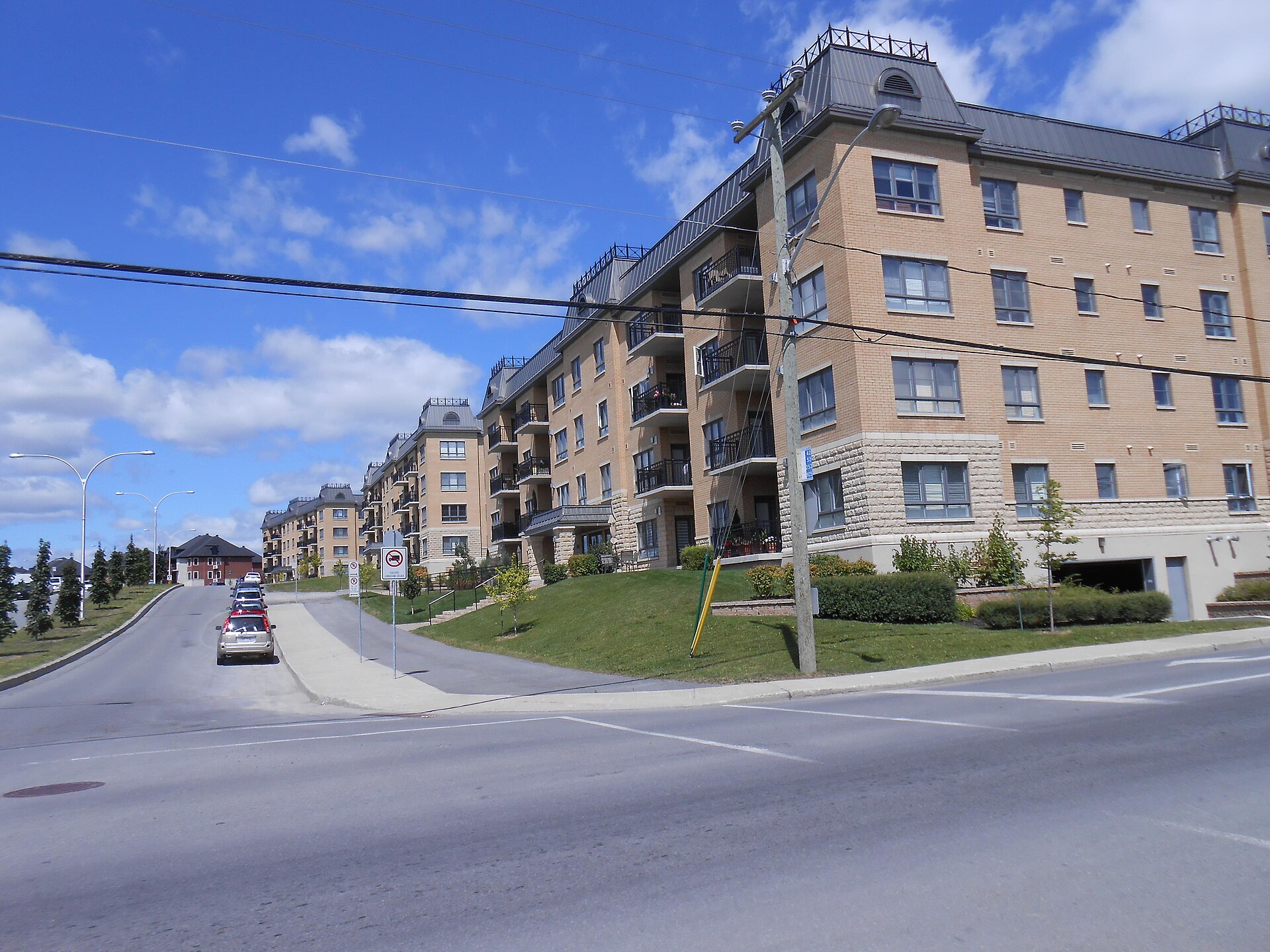
01 Residential buildings at the intersection of Boulevard des Cépages and Boulevard Lévesque Est, in Duvernay
The picture

Laval's largest neighbourhood, in three pieces

Of Laval's fourteen neighbourhoods, Duvernay is the largest by area, ahead of Saint-François. It had 30,639 residents at the 2011 census, spread across three quite distinct sectors: Duvernay-Ouest, also called Val-des-Arbres, south of Highway 440; Duvernay-Nord, whose newer part is called Val-des-Brises; and Duvernay-Est, known as Val-des-Ruisseaux and Arèsville. As a fun bit of geography, the neighbourhood completely surrounds Saint-Vincent-de-Paul, which forms an enclave in its south-central section.

Ask me about it: ask me which of the three sectors fits your project. From one end of the neighbourhood to the other, the construction era can be completely different.
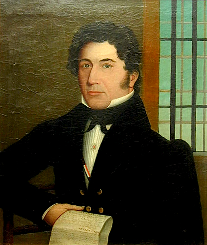
02 Portrait of Ludger Duvernay painted by Jean-Baptiste Roy-Audy in 1832
History

One of the four original municipalities of Île Jésus

The neighbourhood began as the parish municipality of Saint-Vincent-de-Paul, founded in 1740 and incorporated as a municipality in 1855. It shrank piece by piece: part of it went to Saint-Elzéar in 1904, the village of Pont-Viau split off in 1926, and Saint-Vincent-de-Paul followed in 1952. What was left was renamed Duvernay on November 16, 1957, in honour of the printer and journalist Ludger Duvernay, publisher of La Minerve, a Patriote MP, and one of the founders of the Société Saint-Jean-Baptiste. The neighbourhood's name became official on May 12, 1968.

Ask me about it: ask me why some streets in the neighbourhood follow such an unusual layout. It often traces back to old farm lot lines.
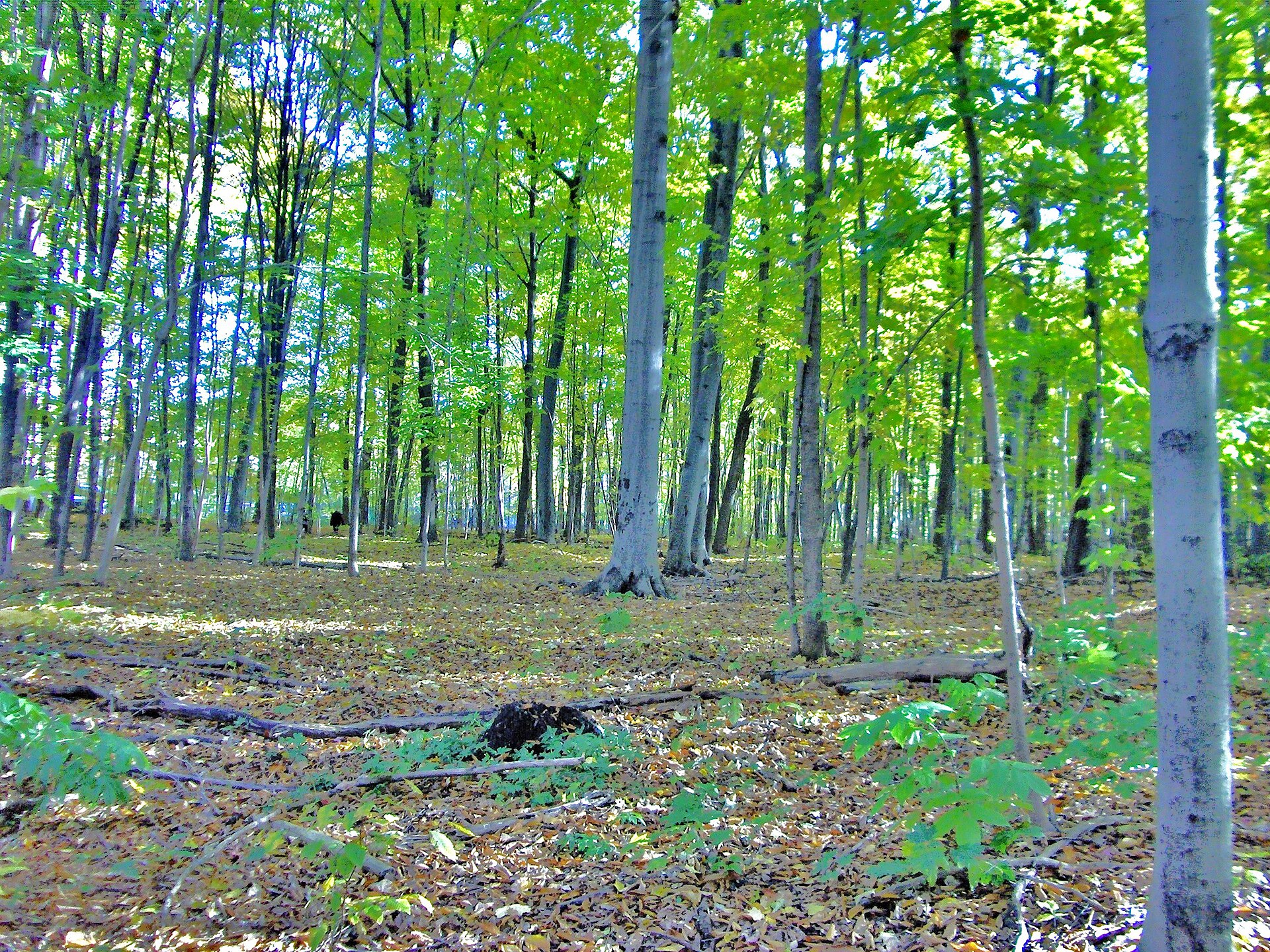
03 Beech understory in Bois Papineau, in Duvernay, in October
Nature

Bois Papineau, a real forest in the city

This is the asset a lot of buyers discover too late. Bois Papineau covers one square kilometre, more than a hundred hectares, right in the middle of an urban area. There are nearly seven kilometres of trails running through it, through a pre-colonial beech grove where some trees are more than two hundred years old, a maple and hickory grove, a meadow, marshes, and a stream. More than three hundred species of plants, trees, and shrubs have been catalogued there, and a welcome pavilion serves as the starting point.

Ask me about it: ask me which streets give walking access to the trails. It's an argument I use every time I show someone around this area.
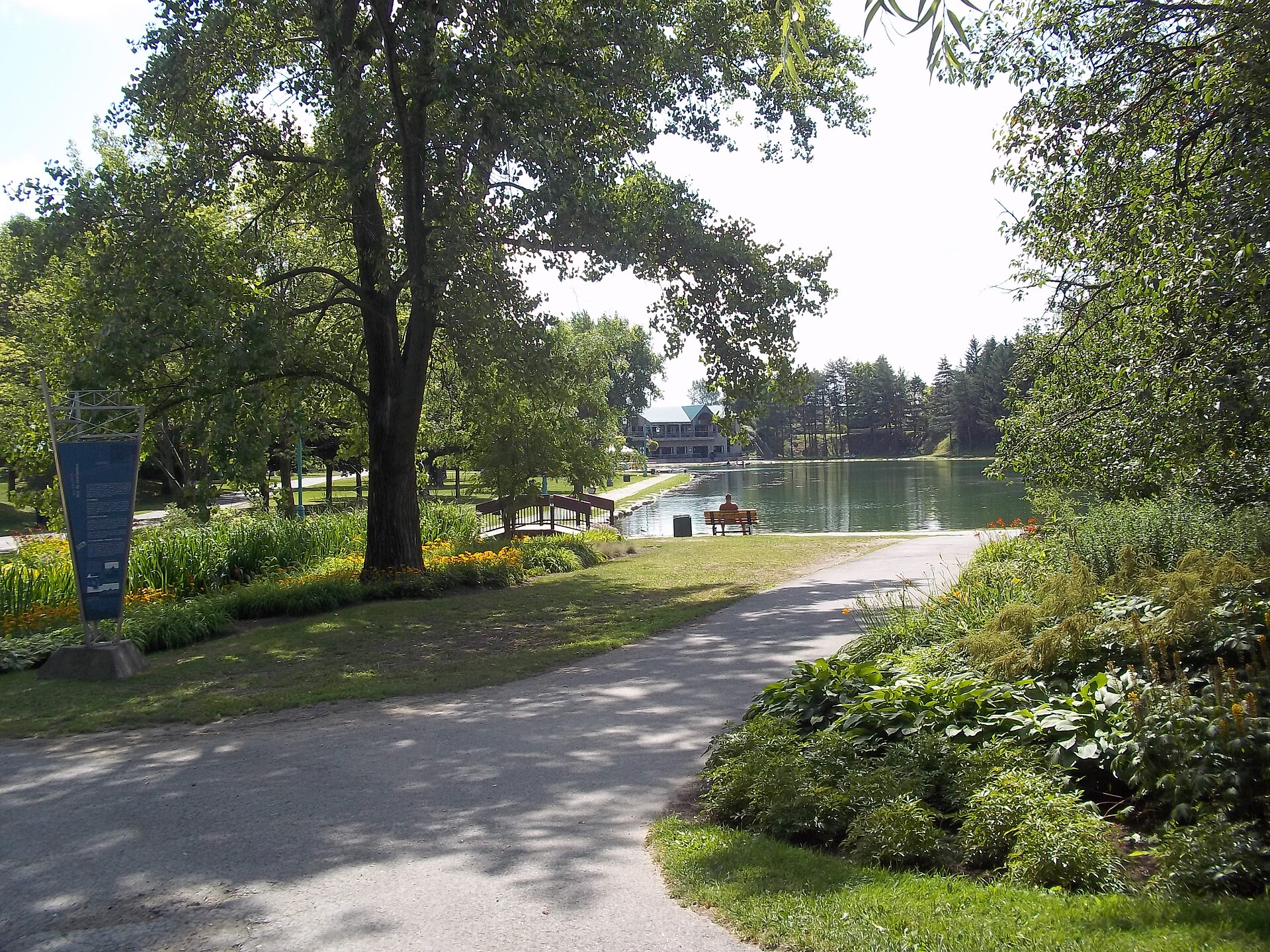
04 The lake and trails at Centre de la nature de Laval, in the Saint-Vincent-de-Paul enclave
Outdoors

Centre de la nature, right in the middle of the enclave

It's technically located in Saint-Vincent-de-Paul, but since Duvernay wraps around that enclave, residents here walk or bike over to it. Fifty landscaped hectares built on a former quarry and, in part, an old dump: it's one of the rare redevelopments of its kind in North America. Opened to the public in 1970, it has a large lake, greenhouses, farm animals, an astronomical observatory, and year-round outdoor programming.

Ask me about it: ask me what it changes to have a park this size as a neighbour. Families with young kids figure it out fast.
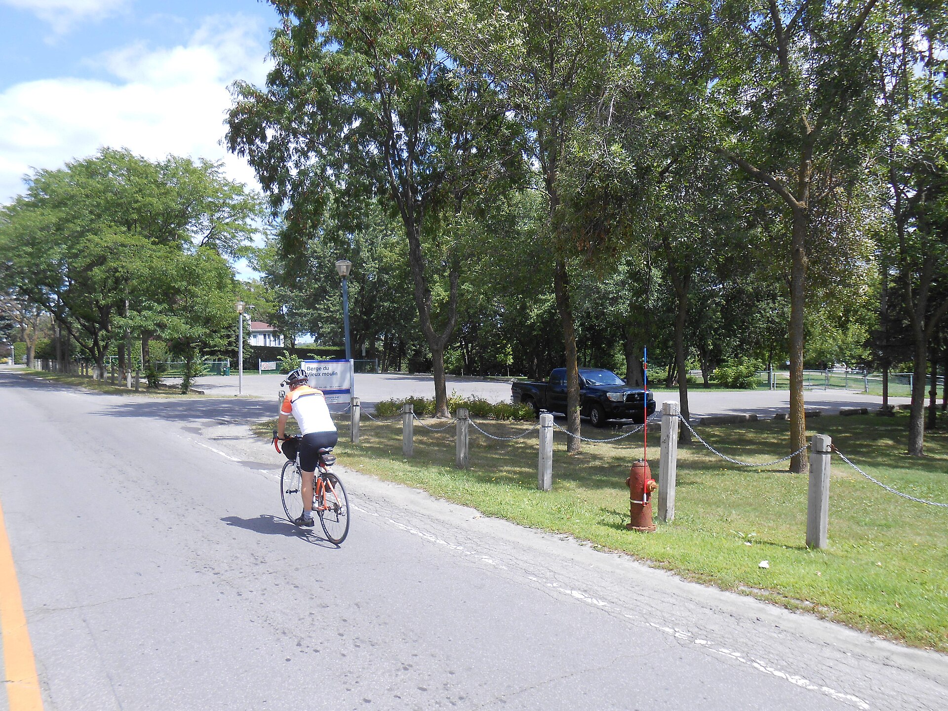
05 A cyclist passes the entrance to the Vieux-Moulin shoreline, on Boulevard Lévesque Est, in Laval
Waterfront

Boulevard Lévesque Est and its shoreline

The neighbourhood's entire south edge faces the rivière des Prairies, and Boulevard Lévesque Est runs along nearly its full length. It's the scenic route through the area: cyclists ride it in the morning, municipal shorelines like Vieux-Moulin give access to the water, and the homes on the south side of the boulevard have the river in their backyard. Across the water is Montreal.

Ask me about it: ask me which addresses have real water access rather than just a view. The difference matters a lot at resale.
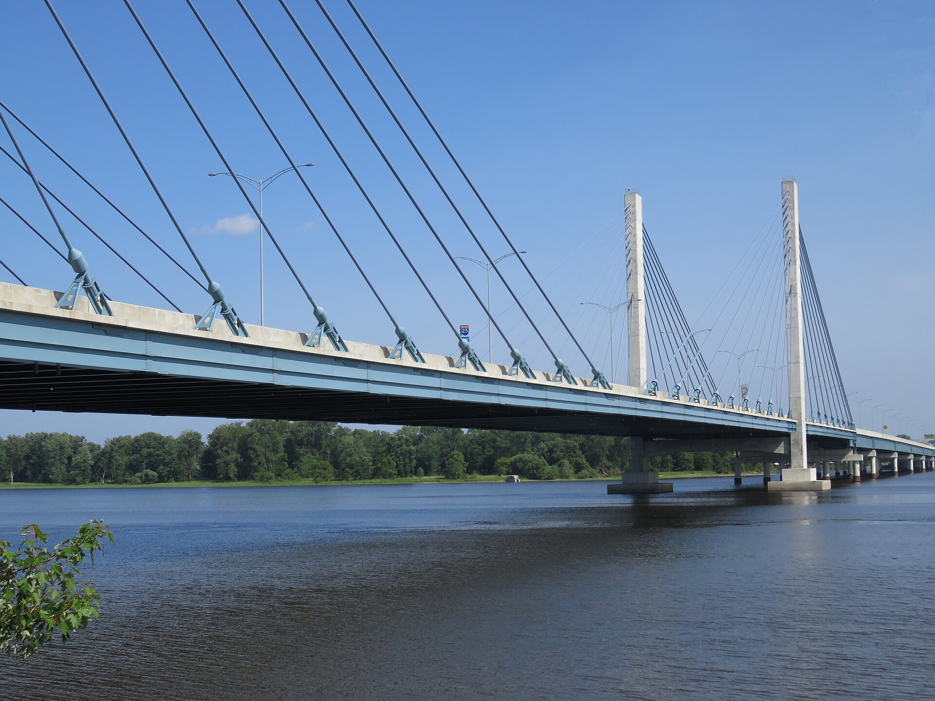
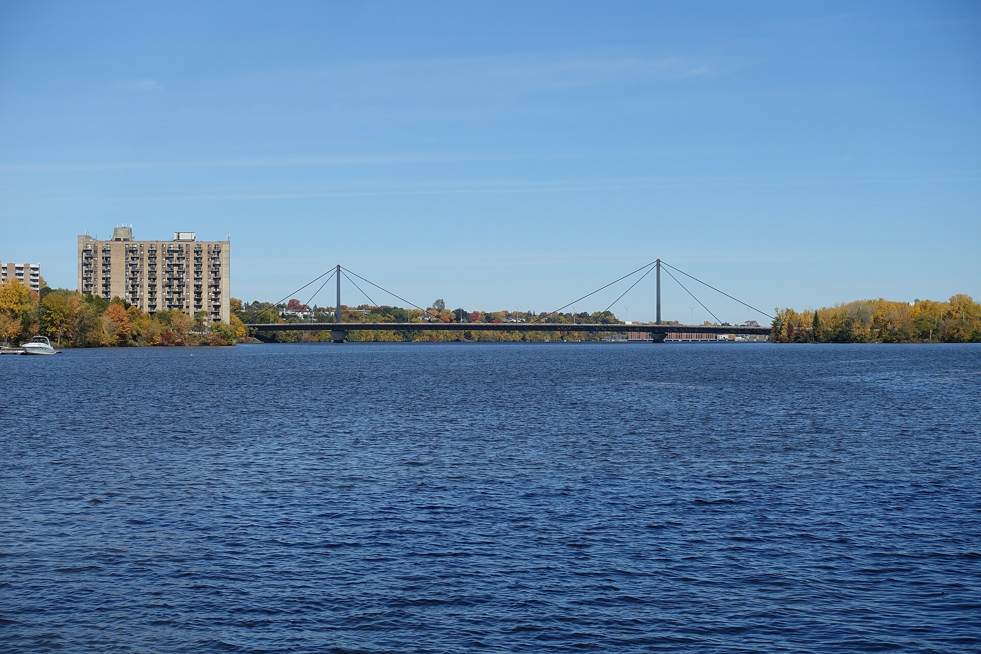
06 The cable-stayed section of the Olivier-Charbonneau bridge, on Highway 25, seen from Laval
Access

The Olivier-Charbonneau bridge, the big change

Opened to traffic on May 21, 2011, this 1,200-metre bridge, with its 500-metre cable-stayed section, completed Highway 25 and connected it directly to Highway 440 and the Louis-Hippolyte-La Fontaine tunnel-bridge. Six lanes, a bike path on the east side, and an electronic open-road toll run through a 35-year public-private partnership, free for pedestrians, cyclists, and electric vehicles. It's named after Olivier Charbonneau, the first settler on Île Jésus. This bridge is what relaunched residential development in Duvernay-Est.

Ask me about it: ask me to work out what the toll really costs over a year, transponder in hand. A lot of buyers overestimate the bill.
07 The Papineau-Leblanc bridge seen from the Laval shore of the rivière des Prairies, in fall
Road network

Three highways and a boulevard that acts like one

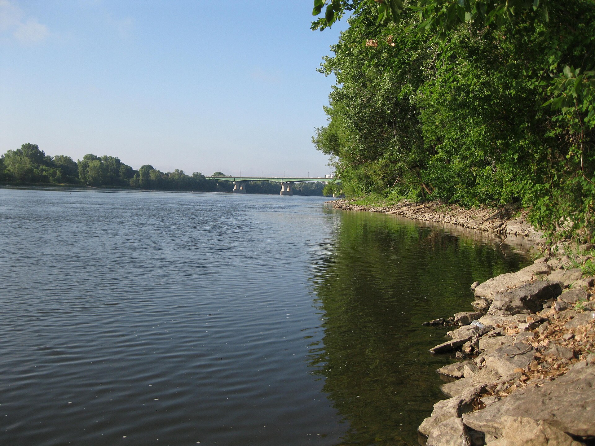
Few neighbourhoods are this well connected to the network. Highway 440 crosses Duvernay from west to east, the Autoroute Papineau (19) and Highway 25 run north to south, and Boulevard Pie-IX plays the same role even though it's officially just a road. The Papineau-Leblanc bridge, put into service in 1969, spans the river in a single 241-metre stretch between its two piers and comes out at Île de la Visitation. Its name honours Joseph Papineau and Alpha Leblanc, the market gardener who owned the land at the approach on the Laval side. Further north, in the Route 335 corridor that borders the neighbourhood, the extension of Highway 19 toward Bois-des-Filion calls for eight kilometres of divided, grade-separated road between Highway 440 and Highway 640, four new interchanges, and reserved lanes for public transit.

Ask me about it: ask me which bridge to take depending on your departure time and destination. I've run that test more often than I'd like.
08 The rivière des Prairies and the Pie-IX bridge seen from the Laval shore
Public transit

Ten bus routes and two ways to reach the metro

The Société de transport de Laval serves the neighbourhood with ten routes: the 22, 42, 48, 50, 52, 58, 70, 222, 252, and 925, plus the T07 taxibus. Depending on the line, you end up at Cartier metro, Henri-Bourassa metro, Radisson metro, or the Le Carrefour terminus. The 48 also connects to Vimont station, on exo's Saint-Jérôme line. And since November 2022, rapid bus service has been running along Boulevard Pie-IX from the foot of the bridge to the metro station of the same name, giving a direct link to the green line.

Ask me about it: ask me for real door-to-door times to your workplace. We check them together before you make an offer.
09
Family life

Schools in every sector

The Centre de services scolaire de Laval runs Leblanc secondary school here and five elementary schools: des Ormeaux, J.-Jean-Joubert, Notre-Dame-du-Sourire, Val-des-Arbres, and de Val-des-Ruisseaux. The Sir-Wilfrid-Laurier school board, for its part, runs three English-language elementary schools, Genesis, Jules-Verne, and Saint-Paul, which is a fairly rare combination within a single neighbourhood. The Institut de protection contre les incendies du Québec, which trains the province's firefighters, is also based here.

Ask me about it: ask me which school serves the address you're interested in. Catchment zones don't always follow the logic you'd expect.
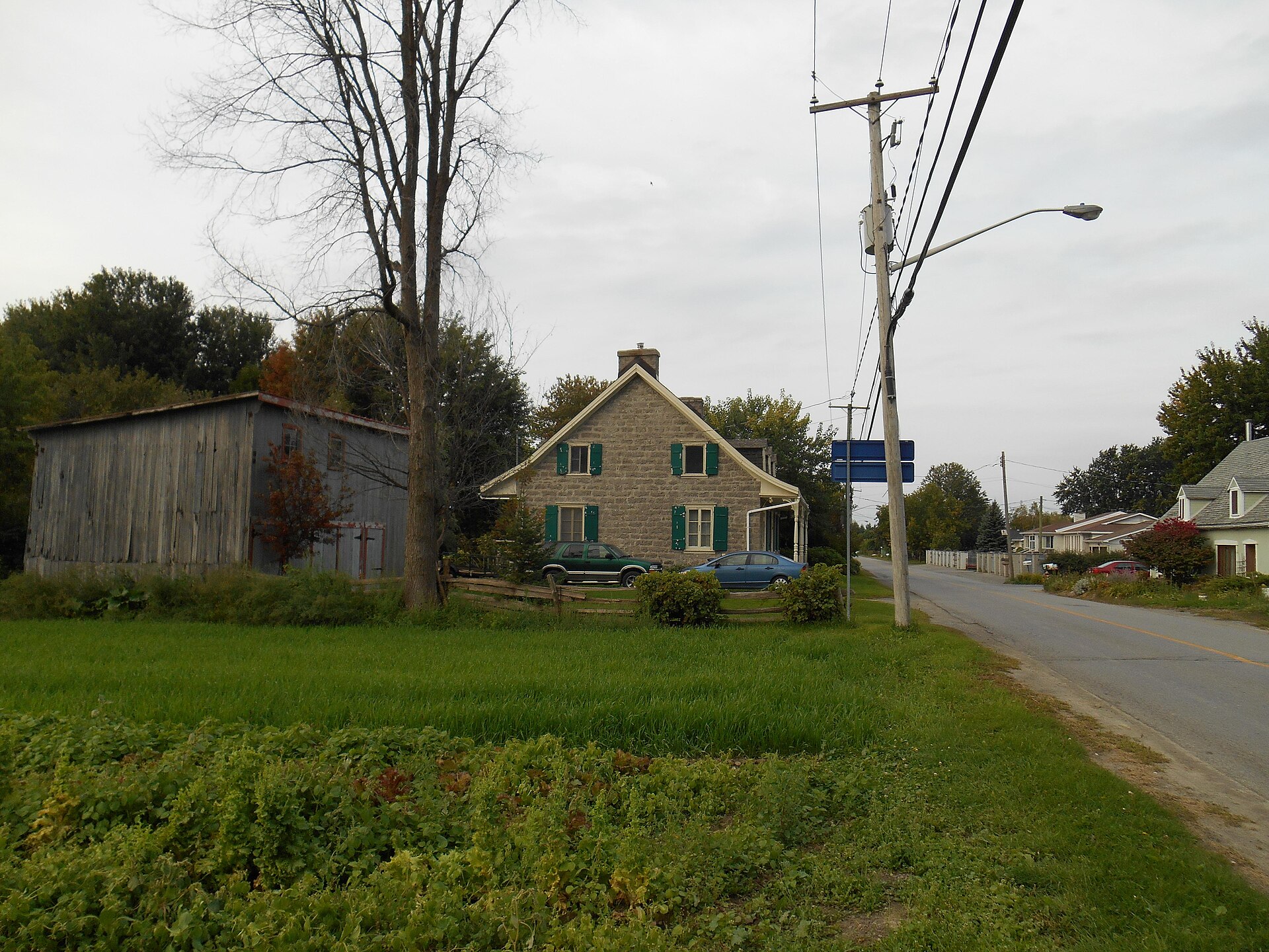
10 Stone house and old barn bordering a cultivated field, on Rang du Haut-Saint-François in Laval
Heritage

A north end still being farmed

This is the part of Duvernay that people from Montreal never suspect exists. A good portion of Duvernay-Nord is in a permanent agricultural zone, around Rang Saint-Elzéar and Rang du Haut-Saint-François, where several fruit and vegetable growers still work the land. At the 1965 merger, only 12 percent of the territory of the city of Duvernay was urbanized. Rang du Haut-Saint-François continues on into the Saint-François neighbourhood, where the Pierre-Paré house, built in the early nineteenth century and classified as a heritage building in 2012, is a reminder of what the local farms once looked like.

Ask me about it: ask me what agricultural zoning protects and what it prevents. It's the question to settle before buying in the north end of the neighbourhood.
Let's talk

Thinking about buying or selling in Duvernay? Let's start with a conversation.

A free evaluation of your property, a picture of the local market, or simply answers to your questions. No strings attached, and a straight answer.

Start my real estate project

Photo credits