← Back to the Laval map
Area · Îles-Laval, southwest Laval

Îles-Laval

Four islands in the rivière des Prairies, a single bridge for driving in, and a REM station right at the end of the street. Here's my top 9, neighbour's version, not brochure version.

Let's talk about this area

Îles-Laval is the smallest neighbourhood in Laval by area, and by far the strangest to explain over the phone. We're talking about four islands sitting in the rivière des Prairies, between Île Jésus, Île Bizard, and the island of Montreal, with about a thousand people living there year-round. A lot of my clients don't even know it exists until they come across a listing and wonder where on earth it is.

This is an area I take my time showing, slowly, because everything comes down to the details: which street you're on, the walking distance to the station, the relationship to the water. I put this top 9 together to give the straight answer, the good parts along with the quirks. Every point comes with an opening for a conversation. Use it.

Maxime Laforest, residential and commercial real estate broker · Équipe Loiselle, RE/MAX Dynamique

The area's top 9

What makes Îles-Laval tick.

Nine things to know about Laval's most low-key neighbourhood, the one almost nobody talks about and its residents never want to leave.

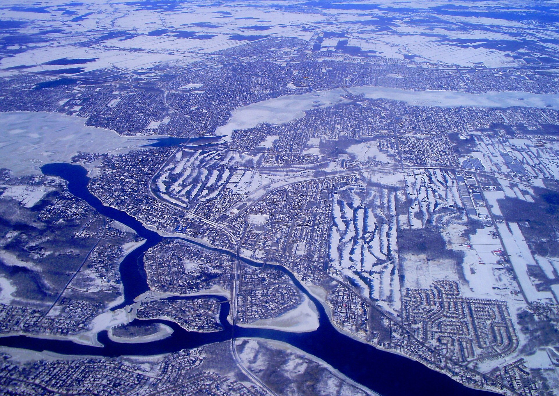
01 Aerial view of southwest Laval, where the Lac des Deux Montagnes splits between the rivière des Mille Îles and the rivière des Prairies
Geography

Four islands, one neighbourhood

The archipelago is made up of Île Bigras, the largest at about a kilometre long, Île Pariseau, Île Verte, and Île Ronde. It sits just downstream from Lac des Deux Montagnes, right where the water splits in two: the rivière des Mille Îles heads north of Île Jésus, and the rivière des Prairies flows south and wraps around the islands. It's the only corner of Laval where you live in the middle of the current rather than on the shore.

Ask me about it: ask me what really sets one island apart from the next. They don't share the same feel or the same type of housing, and it's obvious the moment you visit.
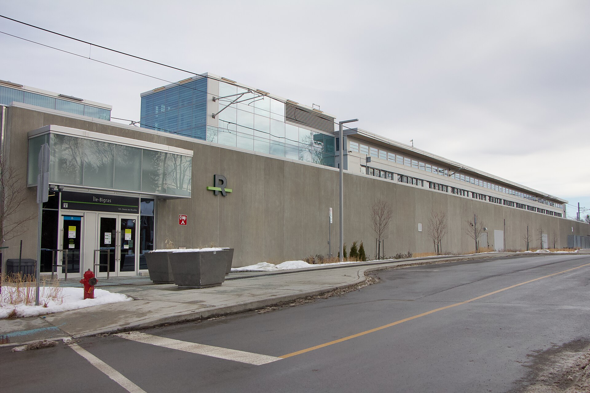
02 The REM's Île-Bigras station, with its entrance facing Chemin des Rocailles
Transit

A REM station on an island of a thousand residents

On November 17, 2025, the REM's Deux-Montagnes branch entered service and the Île-Bigras station opened its doors. A central platform, two tracks, an accessible station, in fare zone B, with Sainte-Dorothée station on one side and Pierrefonds-Roxboro on the other. From there, trains run straight through to Gare Centrale and McGill with no transfer. Few areas this small anywhere in Quebec can say the same.

Ask me about it: ask me what the station actually changes for resale value here. It's the strongest argument in the area, and it doesn't play out the same way on every island.
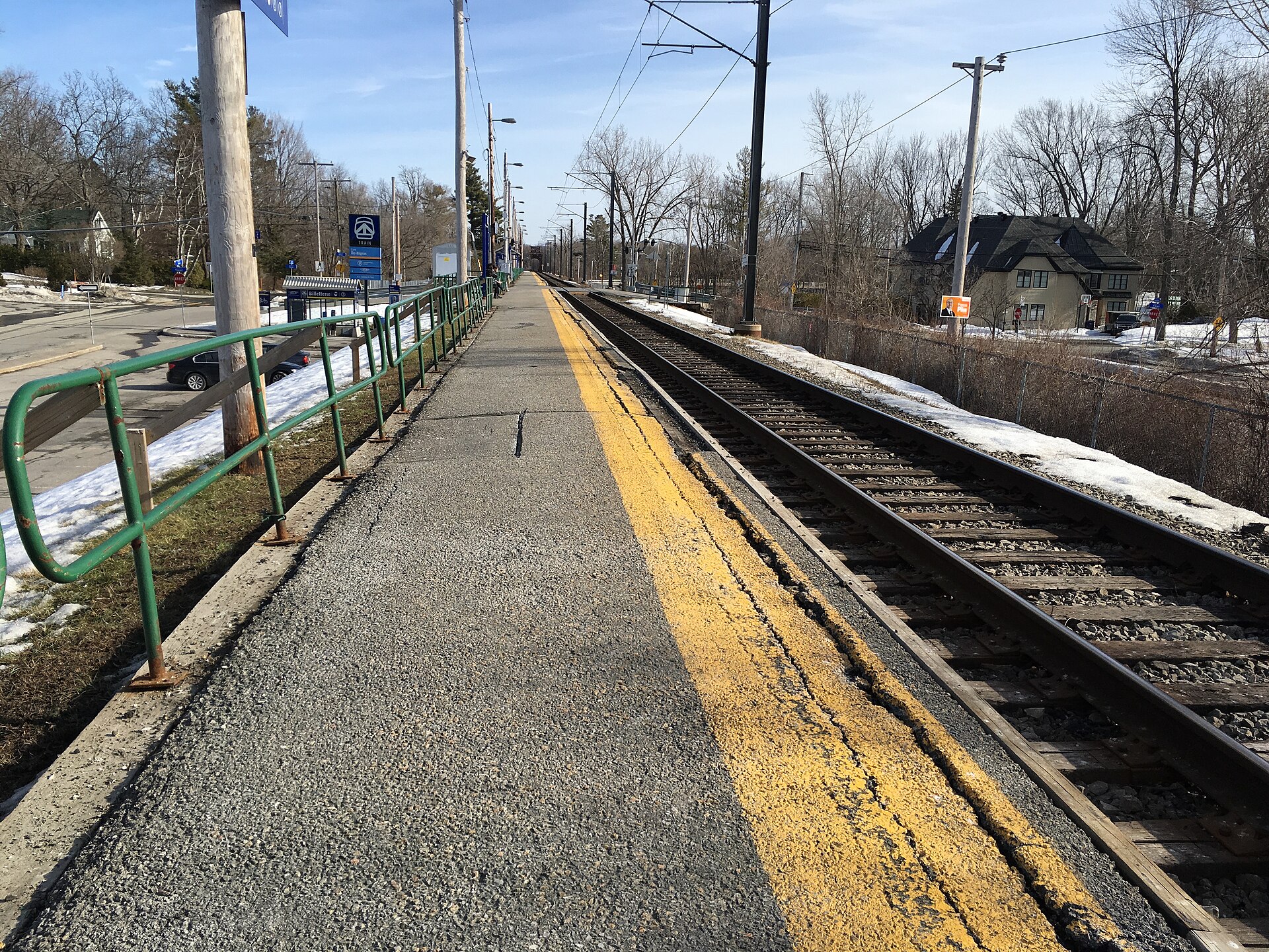
03 The former platform of Île-Bigras station on the Deux-Montagnes line, before the switch to the REM
History

Trains have run through here since 1918

The Deux-Montagnes line has crossed Île Bigras for more than a century. The station as residents knew it opened in 1995, with the line's re-electrification, then closed in 2020 to make way for the REM construction. Five years without service felt long to the islanders. From the old platform, you could see the houses on Chemin du Bois just a few metres from the tracks, and that's still true today.

Ask me about it: ask me which addresses really sit right on the rail right-of-way. It's a check I always do before making an offer in this area.
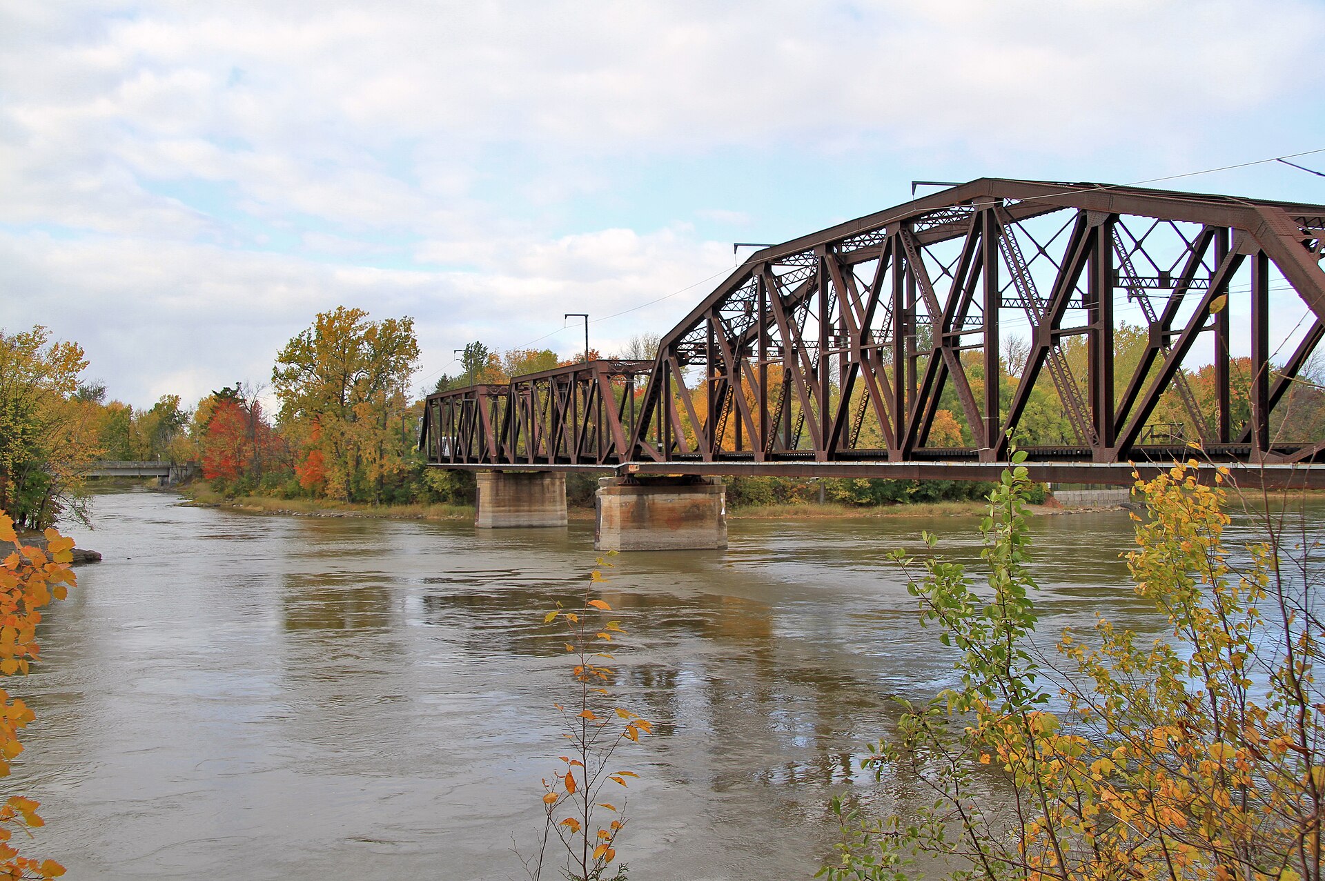
04 The Île Bigras railway bridge, spanning the rivière des Prairies toward Pierrefonds
Waterfront

The steel bridge over the river

Heading south, the track leaves the island on a long steel structure that spans the rivière des Prairies toward Pierrefonds. It's one of the best views in the area, especially in the fall when the shorelines turn colour. All around, the current stays strong: the Lalemant rapids sit just to the west, the Cheval Blanc rapids a bit to the north. This isn't calm, bay-like water, it's a real river.

Ask me about it: ask me what the current means for a dock, a boat launch, or a shoreline. It can be planned for, but it can't be improvised.
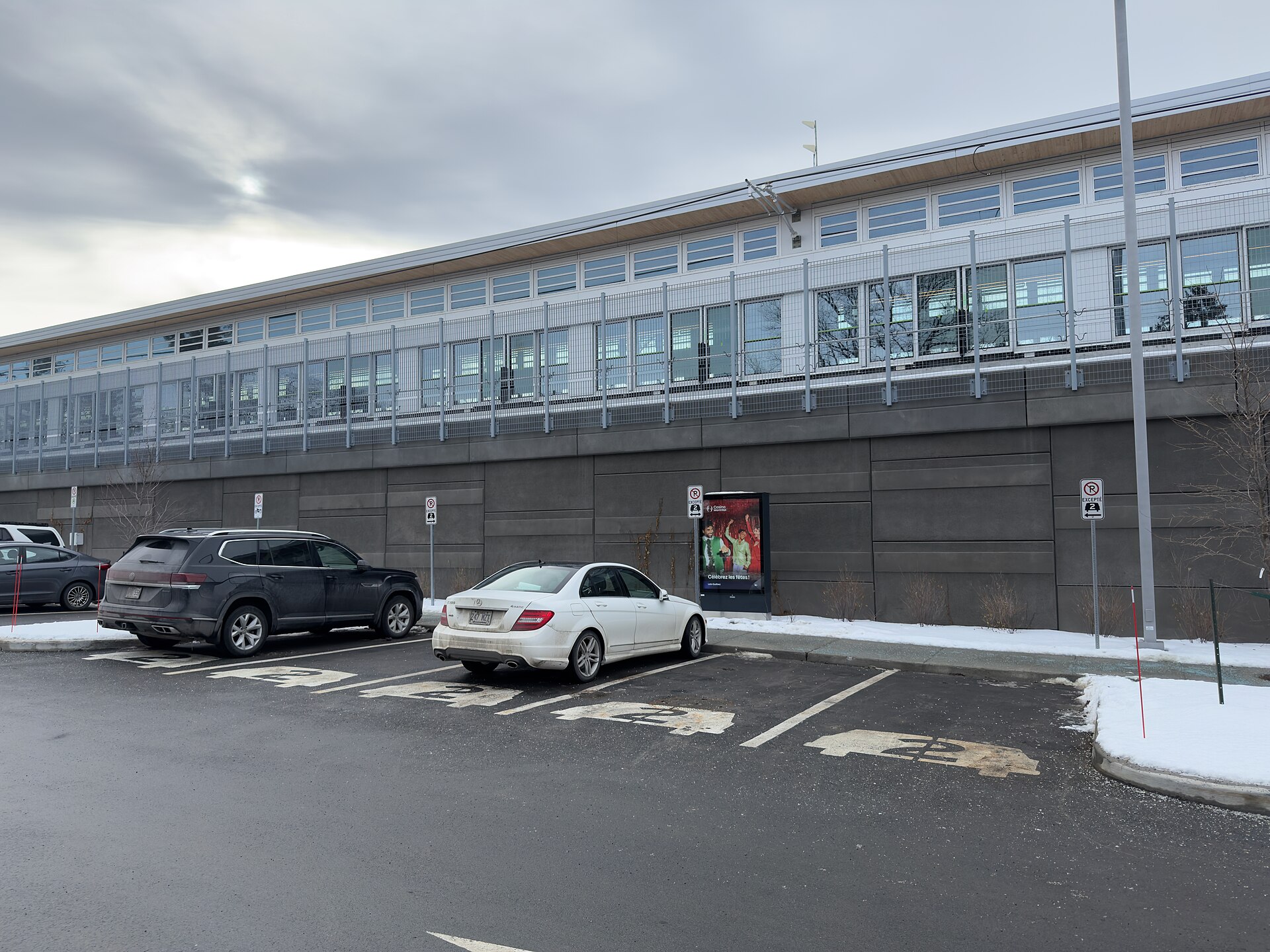
05 The park-and-ride at Île-Bigras station, at the foot of the REM structure
Access

A single bridge to drive in

The whole neighbourhood hangs on a single road link: Rue Dupont, which comes down from Chemin du Bord-de-l'Eau in Sainte-Dorothée and crosses the river channel to Île Bigras. Internally, two small bridges round out the network, Chemin des Trilles to Île Pariseau and Rue Comtois to Île Verte. Beyond that, the station offers 48 park-and-ride spaces and about twenty bike spots, and no bus route serves the islands themselves, but the STL's T26 shuttle connects the Île-Bigras train station to Sainte-Dorothée.

Ask me about it: ask me what living with a single road access is like day to day, winter and summer alike. It's the second question my buyers ask, right after the price.
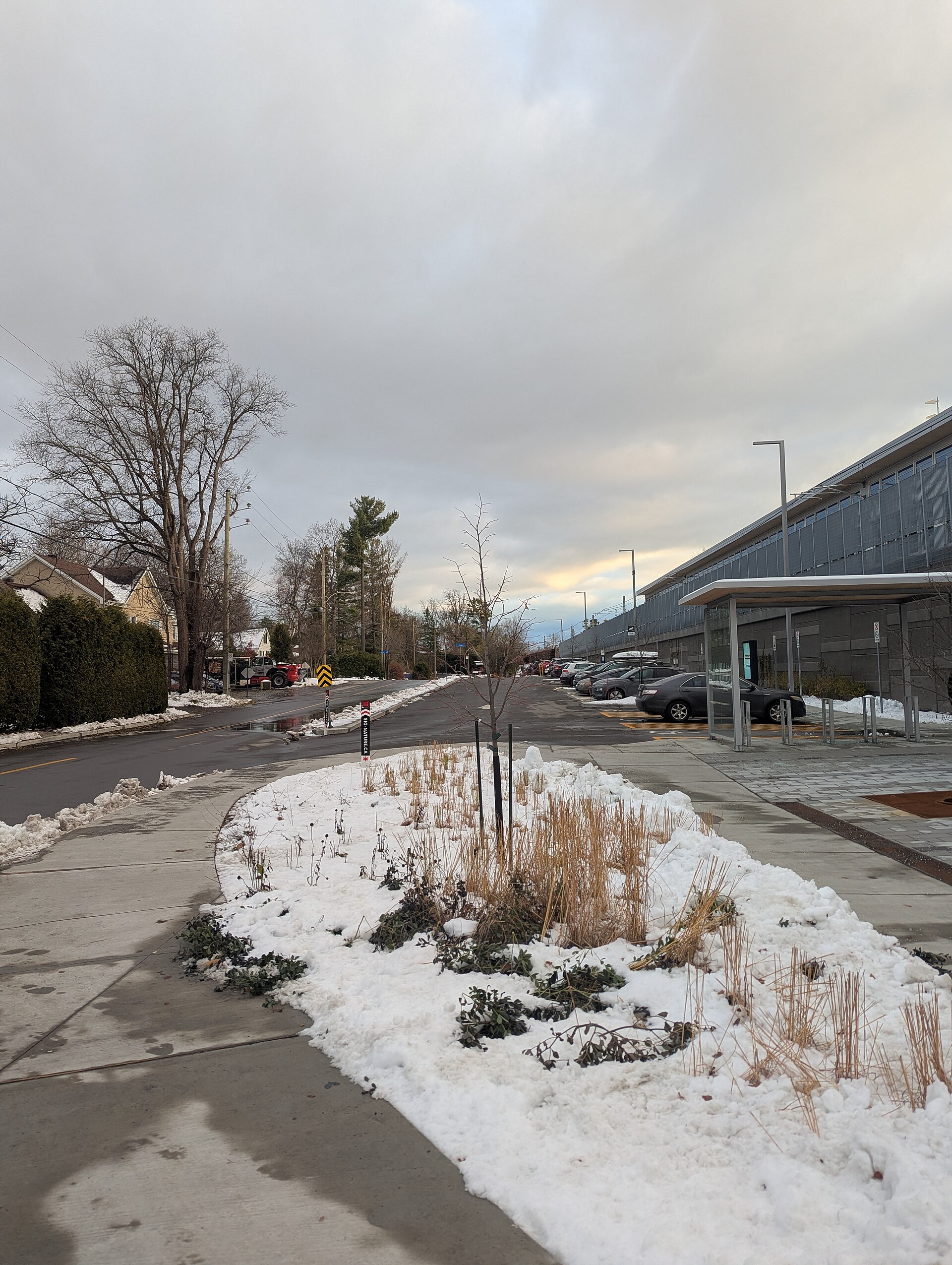
06 A residential street on Île Bigras, with its houses and the REM structure on the right
The streets

Country roads, not boulevards

Here, almost everything is called a chemin: Chemin du Tour, which loops around Île Bigras, Chemin du Bois, Chemin des Trilles, Chemin de la Fourche, Chemin des Rocailles, Chemin du Mistral. Add Rue Pariseau, Rue Comtois, and a few cul-de-sacs, and you've covered the whole neighbourhood. No main artery, no through traffic, barely enough streets to get lost on for five minutes.

Ask me about it: ask me which roads give access to the water and which stay inland. The value gap between the two is bigger than people expect.
07
Nature

Île Ronde, protected for good

Three hectares, no houses, no bridge: Île Ronde is the only one of the four not connected to the mainland. Purchased in the 1960s by Thor Wikström, it was donated in 2021 to Nature Conservancy of Canada to be preserved. Its shores are home to the northern map turtle, a species considered vulnerable in Quebec, along with shagbark hickory and a wetland where fish and amphibians spawn. Canada geese, wood ducks, and common mergansers round out the picture.

Ask me about it: ask me what a protected area right across the water changes for a property. The answer often surprises people, and it's usually good news.
08
Heritage

Three beaches and a resort-town past

In 1912, the real estate firm Gohier et Bigras bought all four islands to develop them. Île Bigras had previously been called Île Amesse, after owner Louis Amesse, until Émilien Bigras acquired it in 1890. For decades, Île Bigras and Île Pariseau lived off summer cottagers and three well-loved beaches. Some houses still show their origins as summer camps, and that's exactly what gives the area its particular character.

Ask me about it: ask me how to spot a former summer house converted for year-round living. Foundation, insulation, plumbing: there are specific things to check.
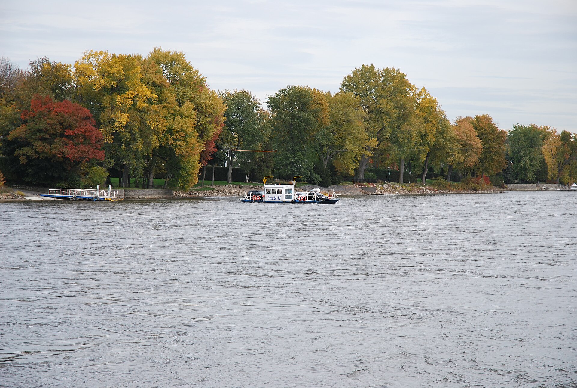
09 The cable ferry on the Laval / L'Île-Bizard crossing, over the rivière des Prairies in fall
Local life

A small village feel with a cable ferry next door

Îles-Laval was once its own municipality, the Ville des Îles-Laval, incorporated on March 20, 1941, following a petition led by lawyer Néopol Charbonneau, right up until the 1965 merger that created today's Laval. From that era, what remains is Parc Bigras, the Bigras community centre, a Catholic church, Notre-Dame-de-l'Espérance, and an Anglican chapel. Nearby, on the Laval-sur-le-Lac side, a cable ferry crosses the river to Île Bizard in five minutes during the season. For shopping, groceries, and schools, Sainte-Dorothée picks up the slack, just a few minutes away by car.

Ask me about it: ask me how a family's daily life is organized here, from schools to errands. It's doable, and plenty of people wouldn't trade it for anything.
Let's talk

Thinking about buying or selling in Îles-Laval? Let's start with a conversation.

A free evaluation of your property, a picture of the local market, or simply answers to your questions. No strings attached, and a straight answer.

Start my real estate project

Photo credits