← Back to the Laval map
Area · Laval-sur-le-Lac, a Laval neighbourhood

Laval-sur-le-Lac

A cable-drawn ferry at the end of the street, streets named after trees, and water on three sides. Here's my top 10, the neighbour's version, not the brochure's.

Let's talk about this area

Laval-sur-le-Lac occupies the western tip of Île Jésus, where the rivière des Mille Îles, the lac des Deux Montagnes, and the rivière des Prairies meet. It's a neighbourhood of 2.1 square kilometres and 766 residents at the 2011 census, the least populated in Laval, and also the most upscale. From my home base in Verdun, I go up the island of Montreal and cross into Laval via Highway 13, which makes this corner an area I love showing to clients who want space and water without leaving the region.

I put together this top 10 for a simple reason: when you buy or sell, you're not just shopping for a property, you're shopping for a neighbourhood life. Each point comes with an opening for a conversation. Use it.

Maxime Laforest, residential and commercial real estate broker · Équipe Loiselle, RE/MAX Dynamique

The area's top 10

What makes the heart of Laval-sur-le-Lac beat.

Ten reasons buyers fall in love with the area, and why the people who are here don't leave.

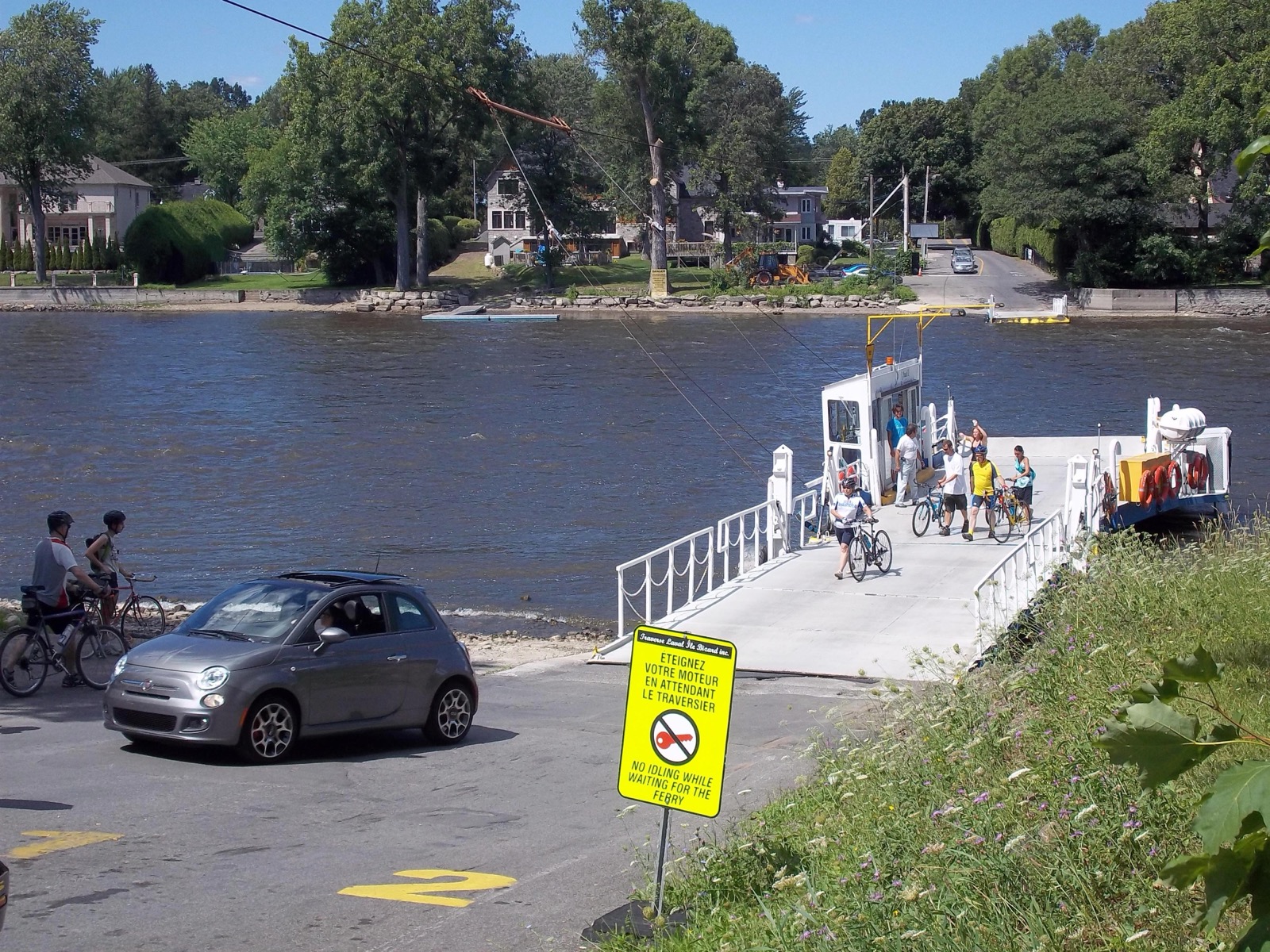
01 The ramp of the Laval-sur-le-Lac and L'Île-Bizard crossing, with cyclists waiting for the ferry
The unusual

The Paule II cable ferry

At the end of rue Les Érables, a cable-drawn ferry shuttles between Laval-sur-le-Lac and L'Île-Bizard, across the rivière des Prairies. The boat is called the Paule II, the service is run by Traverse Laval Île Bizard inc., and it operates seven days a week, from April to the end of November. Cars, motorcycles, bikes, and pedestrians all board together. The Société de transport de Laval even has a bus stop named "across from the ferry," which gives you an idea of how much the ferry is part of daily life here.

Ask me about it: ask me what having this shortcut to the west end of the island changes in a normal week, and what people do from November to April.
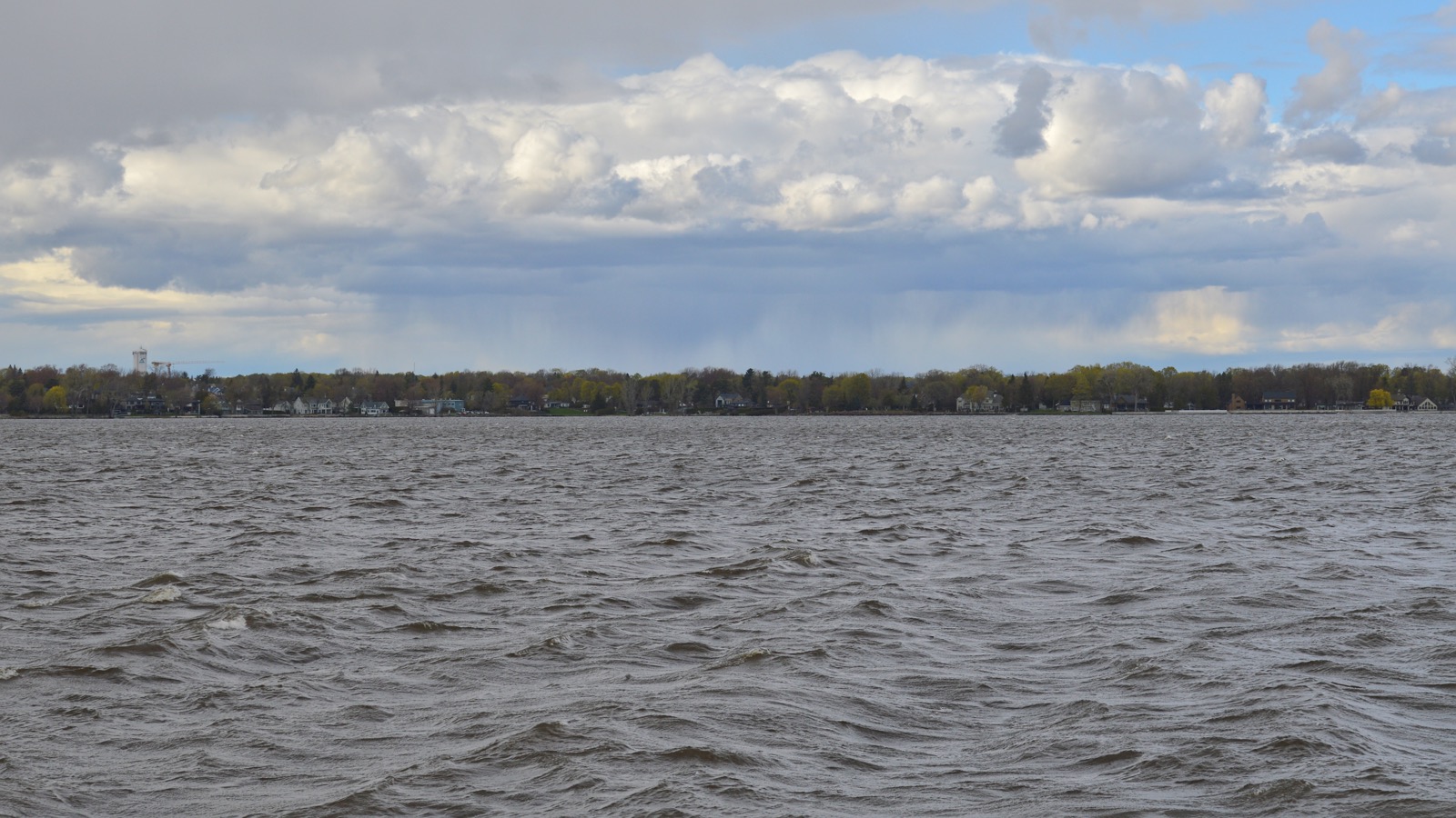
02 The lac des Deux Montagnes seen from the shore, at the western tip of Île Jésus
Waterfront

Water on three sides

The neighbourhood is bordered by the lac des Deux Montagnes to the west, the rivière des Mille Îles to the north, and the rivière des Prairies to the south. Its territory also includes île Roussin, reached by the road of the same name. Three different bodies of water for an area you can drive across entirely in a few minutes, that's a geography you won't find anywhere else in Laval.

Ask me about it: ask me which streets have real water access and which only offer the view. The distinction weighs heavily at resale.
03
History

A neighbourhood planned before it was built

In 1910, a group of investors led by Édouard Gohier, a businessman and former mayor of Saint-Laurent, took an interest in this still-natural land to turn it into a peaceful, strictly residential place. His Compagnie des terrains de Laval bought the lots, subdivided them, then asked Quebec to incorporate the territory as a municipality. The law was passed and the town of Laval sur le Lac was born on March 5, 1915, carved out of land belonging to Sainte-Dorothée and Sainte-Rose. The first council meeting was held on April 8, 1915, in the offices of the Gohier and Bigras real estate agency, in Montreal.

Ask me about it: ask me what traces a plan this strict from the outset still leaves in today's zoning and lot sizes.
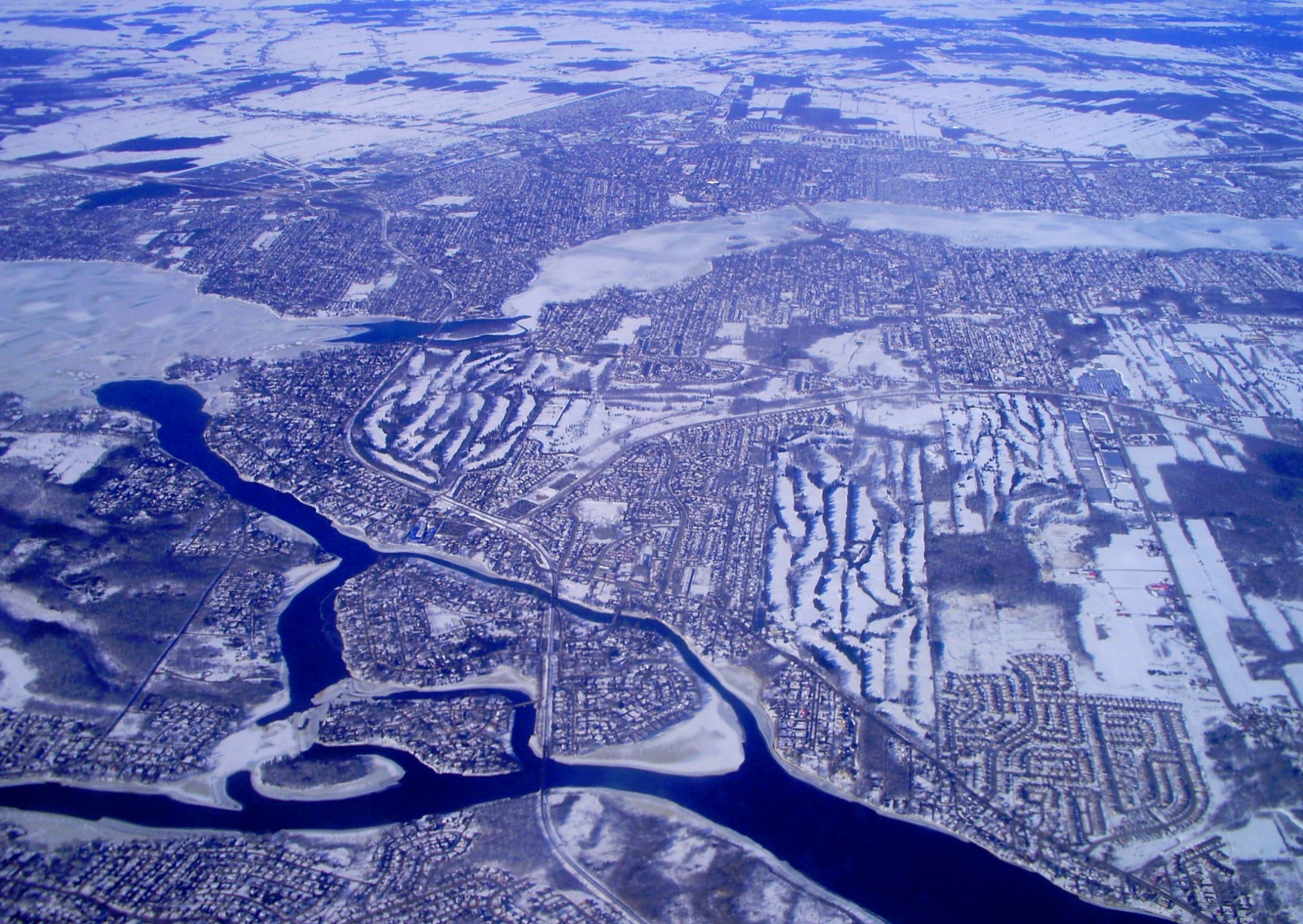
04 Aerial view of southwest Laval, between the rivière des Mille Îles and the rivière des Prairies
The portrait

Laval's smallest neighbourhood

With 766 residents at the 2011 census, Laval-sur-le-Lac is Laval's least populated neighbourhood. It's also the one that stands out for its large houses on large lots and for a proportion of high income households that no other neighbourhood in the city comes close to. Its eastern boundary follows rue Graveline, the old montée of the same name, and it shares the Laval-Les Îles municipal district with the Îles-Laval and parts of Laval-Ouest and Sainte-Dorothée.

Ask me about it: ask me how many properties change hands here in a year. The volume is thin, so timing counts double.
05
Local colour

Streets named like a woodlot

Here, you don't set a meeting point on a boulevard. The streets are called Les Érables, Les Ormes, Les Chênes, Les Cèdres, Les Pins, Les Tilleuls, Les Bouleaux, Les Sorbiers, Les Peupliers, and Les Plaines. Alongside this row of trees, a few names inherited from the summer resort era have survived, like Lakebreeze, Sunny Side, and Peel, and chemin du Bord-de-l'Eau closes the loop. When a client tells me they're looking "in Les Cèdres," I already know which end of the neighbourhood we're talking about.

Ask me about it: ask me which streets are the quietest and which ones see the summer ferry traffic.
06
Sports

Club Laval-sur-le-Lac, golf since 1917

Founded in 1917 and located at 150 rue Les Peupliers, the club first opened nine holes designed by Scottish architect Willie Park Jr., then completed a first 18-hole course in 1923. A third nine was added in 1968 with Howard Watson, a fourth in 1992 with Graham Cooke, which today gives two 18-hole courses, one of them redesigned by Mike Weir in 2013. The Prince of Wales played there in 1924, the Canadian Amateur Championship was held there in 1934, and Jules Huot was head professional from 1945 to 1970. In winter, the neighbourhood's curling centre takes over.

Ask me about it: ask me which addresses back onto the golf fairways. It's an argument I use often on showings, and it doesn't appeal to everyone.
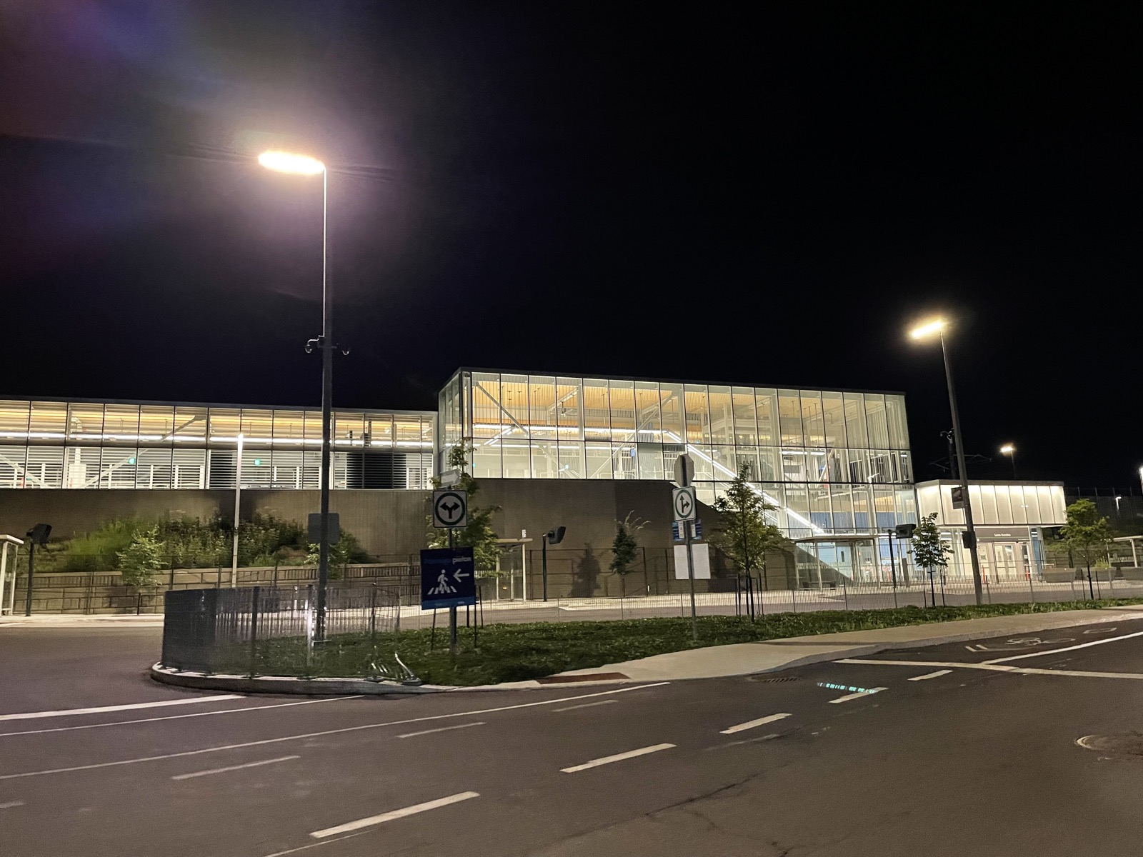
07 The Sainte-Dorothée REM station, in Laval, lit up in the evening
Transit

The REM at the Sainte-Dorothée station

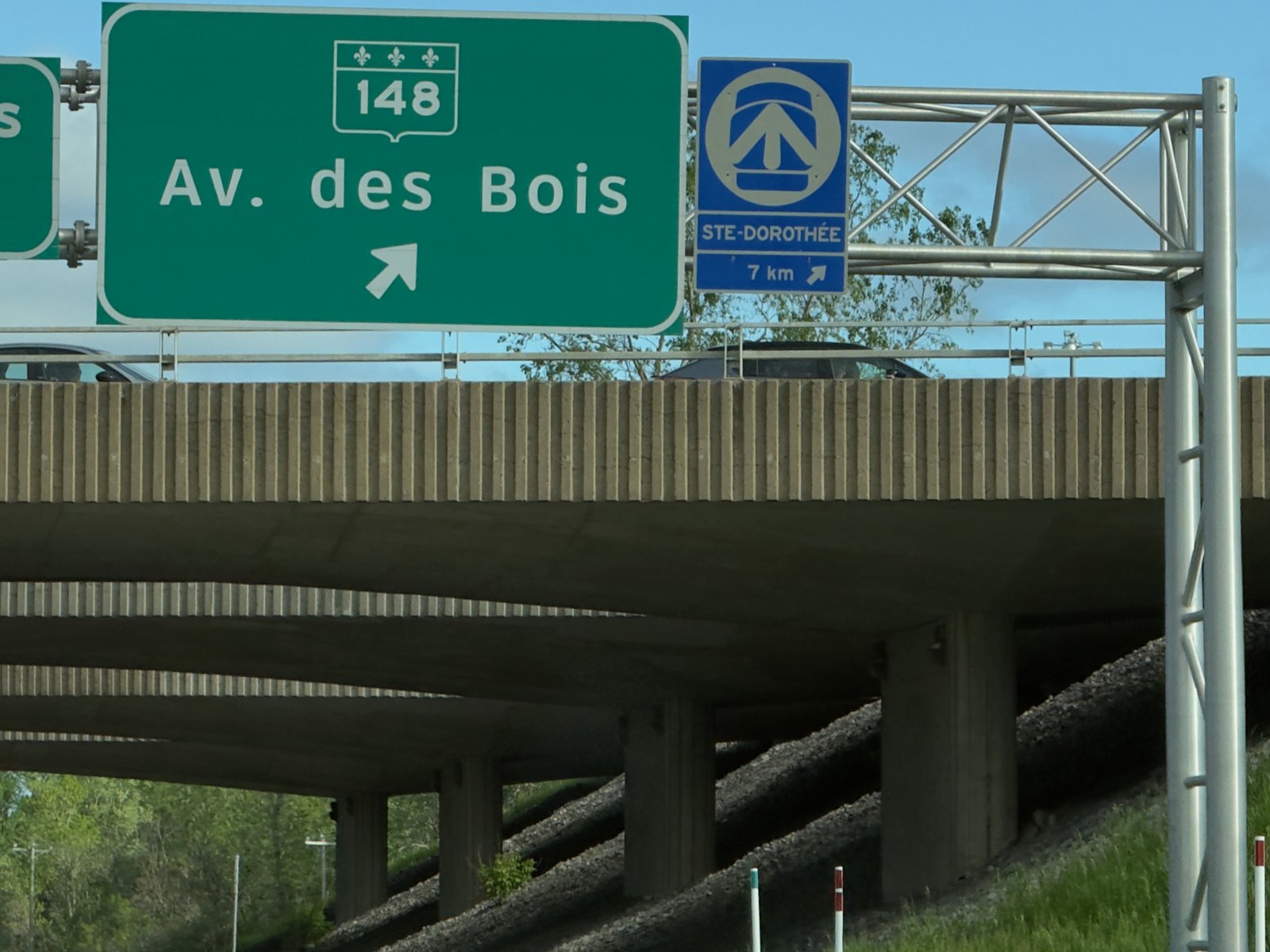
A REM line runs through the neighbourhood's territory, and the nearest station is Sainte-Dorothée, just to the east. The Deux-Montagnes branch went into service on November 17, 2025 with rebuilt stations, platforms with screen doors, and service running twenty hours a day, every day. From Sainte-Dorothée, you head downtown without a transfer, passing under Mount Royal, and the neighbouring Île-Bigras station sits on the other side of the water.

Ask me about it: ask me what the arrival of the REM has changed in how my buyers look at western Laval since 2025.
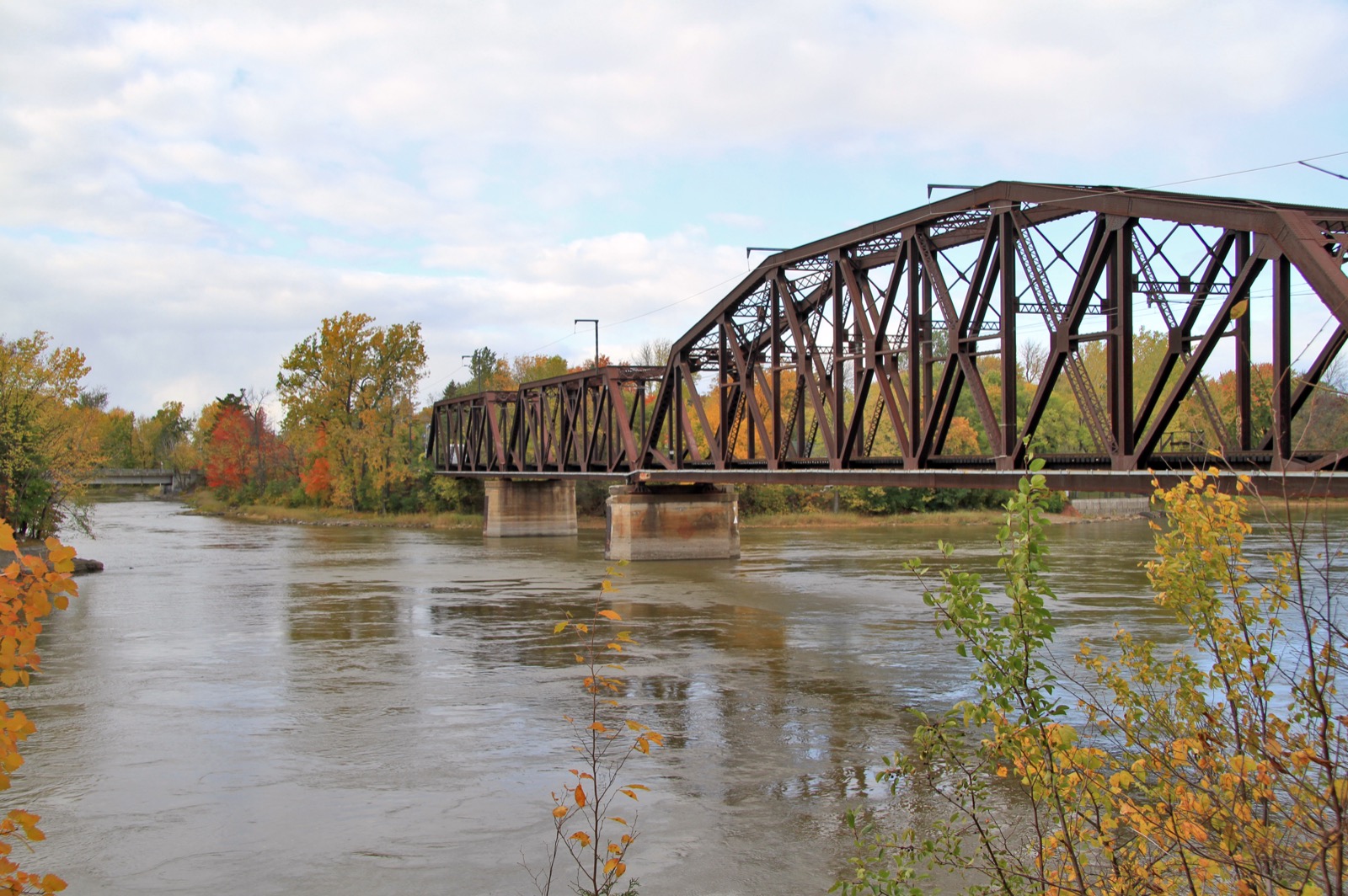
08 The île Bigras railway bridge over the rivière des Prairies, in fall
Heritage

A train in the landscape since 1918

The rail line that cuts through the area is nothing new. The Canadian Northern Railway finished the tunnel under Mount Royal in 1918, and the line was electrified from the start, for lack of sufficient ventilation for steam locomotives. To convert it into the REM, the tracks were doubled over 18 kilometres between Bois-Franc and Deux-Montagnes, fifteen level crossings were removed, and the île Bigras railway bridges were rebuilt starting in 2019. These steel structures over the water have been part of the local landscape for more than a century.

Ask me about it: ask me how the noise and proximity to the tracks feel from one street to the next. That's something you check on site, not on a listing sheet.
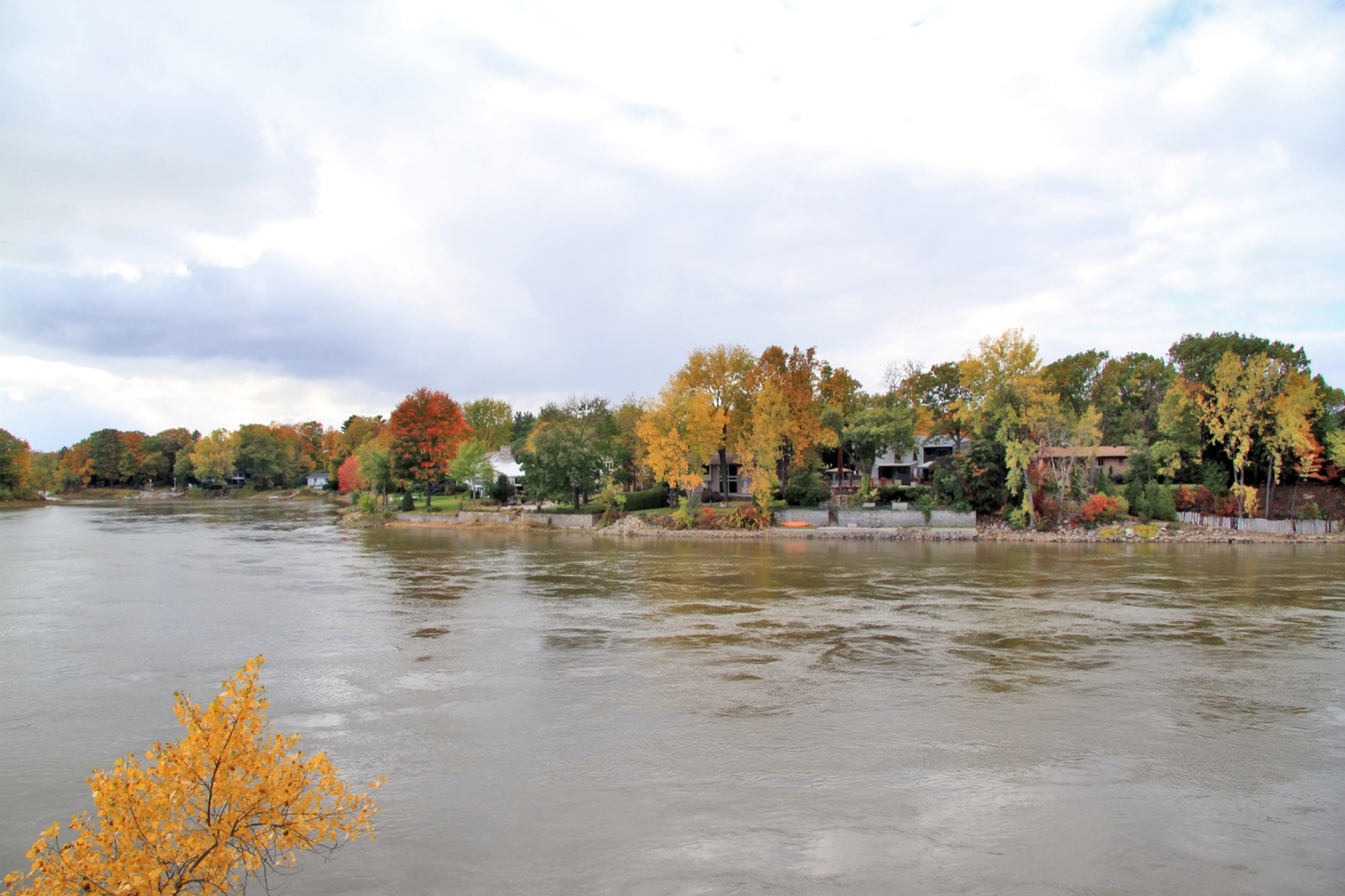
09 Île Ronde, île Bigras, île Pariseau, and île Verte in the rivière des Prairies, in fall colours
The surroundings

The Îles-Laval, right across the water

To the southeast, four islands form the neighbouring Îles-Laval neighbourhood: île Bigras, a kilometre long, île Pariseau, île Verte, and île Ronde, uninhabited at three hectares. It was the same Gohier and Bigras agency that acquired the archipelago in 1912, two years after taking an interest in Laval-sur-le-Lac. The islands were long a summer resort spot, and some houses still hint at their past as vacation camps. Émilien Bigras, who bought the largest one in 1890, gave it his name.

Ask me about it: ask me what to check before buying on an inhabited island, from financing to insurance.
10 Sign indicating the Sainte-Dorothée station at exit 15 of Highway 13, in Laval
Neighbourhood life

Daily life, here and next door

On site, there's the Saint-Jean-Gualbert church at 490 rue Les Érables, served by the Sainte-Dorothée parish, a community centre, and the park at 355 rue Les Érables, renamed parc Fernand-R.-Bibeau in June 2026 in honour of the former town's last mayor, with its two tennis courts, outdoor pool, and play structure. There's no school in the neighbourhood: elementary happens at école Les Trois-Soleils, in Sainte-Dorothée, high school at Saint-Martin then Saint-Maxime in Chomedey, and on the English side at Académie Hillcrest and the Laval Junior and Senior academies. To get out, STL route 76 runs down rue Les Érables to the Sainte-Dorothée station and the Montmorency metro, and Highway 13 leads to the Louis-Bisson Bridge toward Montreal.

Ask me about it: ask me how families plan school runs when they live in a neighbourhood that doesn't have one. A lot of families manage it very well.
Let's talk

Thinking of buying or selling in Laval-sur-le-Lac? Let's start with a conversation.

A free evaluation of your property, a picture of the local market, or simply answers to your questions. No strings attached, and a straight answer.

Start my real estate project

Photo credits